
Boston faces snow threat as next clipper system dives into Northeast overnight
2 min read
The FOX Forecast Center is tracking the end of a series of fast-moving clipper storms that have been impacting the Great Lakes and Northeast. Two systems, one ongoing, and another one, Tuesday night into Wednesday, will bring more rounds of snow, including the threat for dangerous snow squalls.
BOSTON – Another clipper storm is forecast to rapidly move across the Great Lakes and Northeast from Tuesday night into Wednesday, bringing significant snowfall, including plowable amounts, to the Interstate 95 corridor in New England, encompassing the Boston metropolitan area.
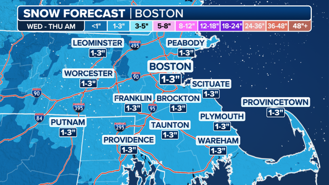
Plowable snow will fall all the way to the I-95 corridor in New England, including the Boston metro.
(FOX Weather)
The FOX Forecast Center is tracking the end of a series of winter storms – one ongoing Tuesday and another one from Tuesday night into Wednesday – that will bring more rounds of snow, including the threat of dangerous snow squalls. As Tuesday’s squalls weaken, attention quickly turns to the Great Lakes, where another storm – the final clipper in the series that began last week – is already taking shape.
SNOW SQUALLS CREATE WHITEOUT CONDITIONS ACROSS INTERIOR NORTHEAST TUESDAY MORNING
The FOX Forecast Center is tracking the end of a series of fast-moving clipper storms that have been impacting the Great Lakes and Northeast.
(FOX Weather)
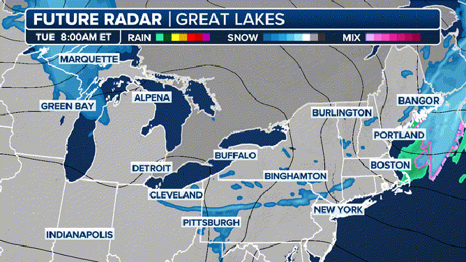
The snow will fall across the Great Lakes on Tuesday, then move into the Northeast overnight and into Wednesday morning.
A few inches of snow is likely from Michigan to Maine. More than a foot of snow will fall in the typical lake-effect areas of the Upper Peninsula of Michigan and downwind of lakes Erie and Ontario in New York. This will be due to the initiation of lake-effect snow after the clipper passes by, the FOX Forecast Center said.
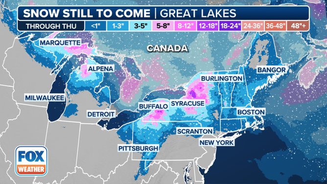
A few inches of snow is likely from Michigan to Maine, with locally higher amounts in the lake-effect snowbelts.
(FOX Weather)
Finally, as the clipper moves off into the Gulf of Maine on Wednesday afternoon, another round of snow squalls is likely along its cold front.
The best chance for these dangerous squalls will be across northern Pennsylvania, upstate New York and into northern New England. The squalls have the potential to produce sudden whiteout conditions and wind gusts up to 40 mph.
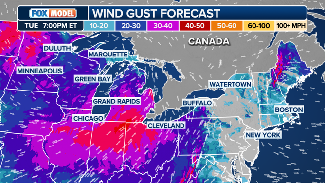
Snow squalls have the potential to produce sudden whiteout conditions and wind gusts up to 40 mph.
(FOX Weather)
Close to the I-95 corridor from New York City southward, it’ll simply be too warm for dangerous squalls with temperatures on either side of 40 degrees. So while flakes may still fall, they are not expected to have much of an impact on area roads.
https://static.foxweather.com/www.foxweather.com/content/uploads/2025/01/umbrella_gif.gif
2025-01-28 14:29:30


