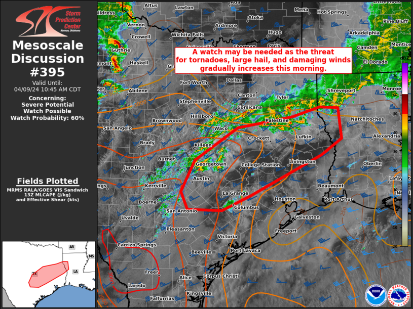
Storm Prediction Center Mesoscale Discussion 395
1 min read
|
|
 |
| Mesoscale Discussion 395 | |
| < Previous MD | |

|
|
   Mesoscale Discussion 0395
   NWS Storm Prediction Center Norman OK
   0126 PM CDT Fri Apr 04 2025

   Areas affected...Parts of south-central into northeast TX

   Concerning...Severe potential...Watch possible

   Valid 041826Z - 042000Z

   Probability of Watch Issuance...60 percent

   SUMMARY...Strong to severe storms are possible this afternoon, with
   a threat of large hail and strong to severe gusts. Some tornado
   potential could also evolve with time.

   DISCUSSION...Early this afternoon, a slow-moving cold front is
   draped from northeast into south-central TX, with another weak cold
   front/wind shift intersecting the primary front west of San Antonio
   and extending southward toward Laredo. Elevated convection is
   increasing to the cool side of the boundary across north-central TX,
   with increasing showers noted across the warm sector noted across
   east-central TX. Storm coverage is expected to increase with time on
   either side of the front, as ascent gradually increases in response
   to an approaching mid/upper-level trough.

   Strong instability (with MLCAPE near/above 3000 J/kg along/east of
   the front and similar MUCAPE magnitudes to the immediate cool side)
   and around 50 kt of effective shear are providing a favorable
   environment for organized convection, and maturing convection this
   afternoon could evolve into a few supercells and/or organized
   clusters, with a threat of large to very large hail and severe wind
   gusts. The KGRK and KHGX VWPs depict a rather strong (35-45 kt)
   low-level jet, and effective SRH will be sufficient to support some
   tornado threat with any sustained warm-sector supercells.

   Watch issuance will become increasingly possible this afternoon if
   observational trends support development of multiple organized
   storms across the region.

   ..Dean/Thompson.. 04/04/2025

   ...Please see www.spc.noaa.gov for graphic product...

   ATTN...WFO...HGX...FWD...EWX...

   LAT...LON   29699754 29929810 30269839 30649841 32309656 32499606
               31999562 31549538 31179554 30629606 30199654 29839732
               29699754

   MOST PROBABLE PEAK TORNADO INTENSITY...100-130 MPH
   MOST PROBABLE PEAK WIND GUST...55-70 MPH
   MOST PROBABLE PEAK HAIL SIZE...2.00-3.50 IN
|
|
|
Top/All Mesoscale Discussions/Forecast Products/Home |
|
2025-04-04 18:50:03


