
Storm Prediction Center Mesoscale Discussion 227
1 min read|
|
| Mesoscale Discussion 227 | |
| < Previous MD | |
|
|
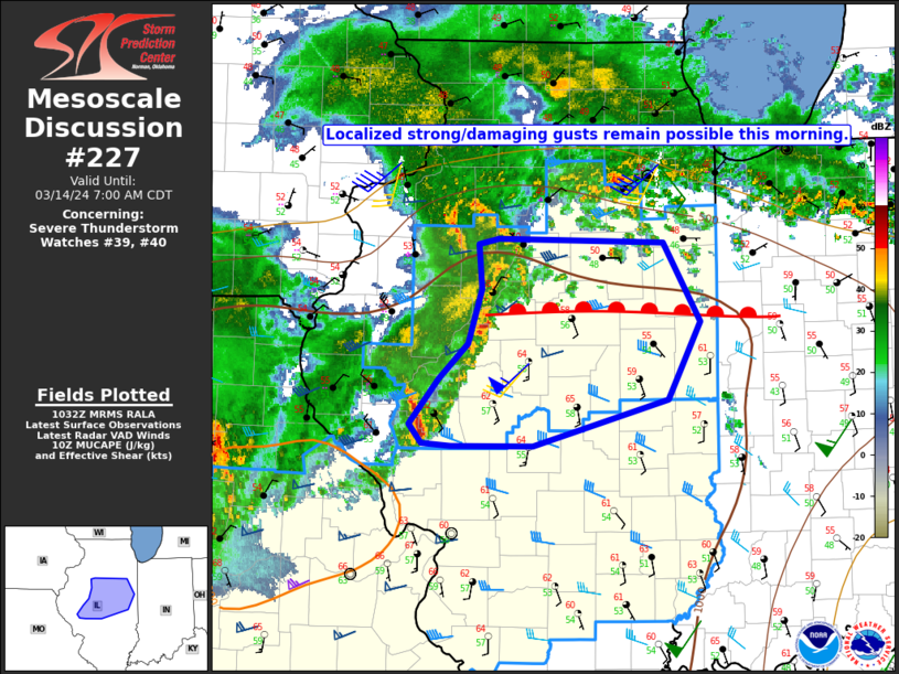
Mesoscale Discussion 0227 NWS Storm Prediction Center Norman OK 1039 AM CDT Sun Mar 16 2025 Areas affected...far southeastern Georgia into the northern and central Florida Peninsula Concerning...Tornado Watch 52... Valid 161539Z - 161715Z The severe weather threat for Tornado Watch 52 continues. SUMMARY...The severe threat continues across Tornado Watch 52. Damaging gusts should be the main threat, though a couple of tornadoes still cannot be ruled out through at least early afternoon. DISCUSSION...Multiple thunderstorm clusters and transient supercells continue to progress across far southeast GA into the northern and central FL Peninsula, with additional storms over the eastern Gulf poised to move ashore over the next few hours. These storms are progressing toward a heated airmass, with surface temperatures already exceeding 80 F in multiple locales. Given 70+ F surface dewpoints, 1000+ J/kg MLCAPE is already in place. While strong flow aloft is contributing to 50+ kts of effective bulk shear, the northward advancement of the upper trough is resulting in deep-layer ascent and the accompanying low-level jet to drift away from the FL peninsula. Regional VADs show a slight decreasing trend in low-level shear. However, these VADs still show adequate hodograph elongation and curvature near the GA/FL border to support a couple of tornadoes. Otherwise, damaging gusts should remain the primary severe threat this afternoon. ..Squitieri.. 03/16/2025 ...Please see www.spc.noaa.gov for graphic product... ATTN...WFO...CHS...MLB...TBW...JAX...TAE... LAT...LON 28638324 29368322 30928265 31348230 31518170 31508147 31368138 30468137 29828119 29408125 28838180 28648229 28588279 28638324 |
|
|
Top/All Mesoscale Discussions/Forecast Products/Home |
|
2025-03-16 15:49:03


