
Today’s top weather news: Storms begin today ahead of looming severe weather outbreak
3 min read
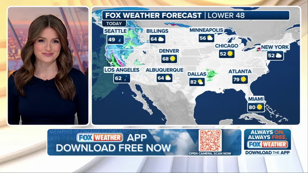
FOX Weather has you covered with the breaking forecasts and weather news headlines for your Weather in America on Wednesday, March 12, 2025. Get the latest from FOX Weather Meteorologist Britta Merwin.
Welcome to the Daily Weather Update from FOX Weather. It’s Wednesday, March 12, 2025. Start your day with everything you need to know about today’s weather. You can also get a quick briefing of national, regional and local weather whenever you like with the FOX Weather Update podcast.
Multiday severe weather threat begins today as confidence grows in potential outbreak later this week
More than 4 million people in southeastern Oklahoma, northeastern Texas, northwestern Louisiana and western Arkansas have been placed under a level 2 out of 5 risk on NOAA’s Storm Prediction Center’s (SPC) severe thunderstorm risk scale on Wednesday.
Thunderstorms are forecast to develop late Wednesday afternoon and into the evening. The coverage of these storms will be somewhat limited but could pack a punch with large hail, damaging winds and the potential for a tornado.
Meanwhile, there’s increased confidence from computer forecast models regarding a potential severe weather outbreak beginning late Friday afternoon. The threat area spans the entire length of the Mississippi River, from Minnesota down to Louisiana.
More than 13 million people are in the greatest threat area, a level 3 out of 5 on the SPC’s risk scale, covering parts of: Iowa, Missouri, Illinois, Kentucky, Tennessee, Mississippi, Alabama and Arkansas.

(FOX Weather)
California atmospheric river event triggers evacuation alerts around burn scars
The same storm that’s bringing that potential severe weather threat is currently dumping heavy rain and bringing strong winds to California.
On Tuesday, Los Angeles authorities issued evacuation warnings for residents around burn scars created by the Eaton and Palisades wildfires in January, as the risk of heavy rainfall threatened to create a muddy mess for homes and businesses that survived the initial flames.
Computer forecast models show as much as 1-4 inches of rain is still to come during the rest of the workweek.
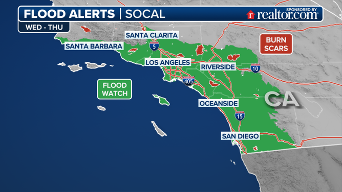
California flood alerts for March 12-13, 2025.
(FOX Weather)
Dangerous winds expected to fuel blizzards, fires
Widespread power outages and blizzard conditions are likely in the Plains on Friday due to blowing snow. This is part of the same system that’s bringing severe weather.
Strong winds are the biggest concern. Chicago, Milwaukee and Minneapolis are bracing for high-impact wind conditions and likely airport delays.
Those winds will also enhance the fire weather threat in New Mexico and Texas, which are currently experiencing dry conditions. Friday appears to be the most dangerous day, as a powerful storm system and an intense 100-plus-mph jet stream move into the southern Plains.
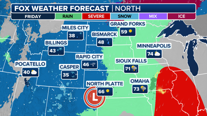
FOX Weather forecast for Friday, March 14, 2025.
(FOX Weather)
Watch this: Home security camera captures moment EF-2 Florida tornado rips through Orlando-area neighborhood
There’s new video of a strong tornado that was captured on a home security camera Monday as it tore through neighborhoods in Longwood, Florida.
Video from Don Shenoy’s home about 15 miles north of Orlando showed howling winds whipping around as the EF-2 tornado ripped down tree branches and tossed debris across the yard.
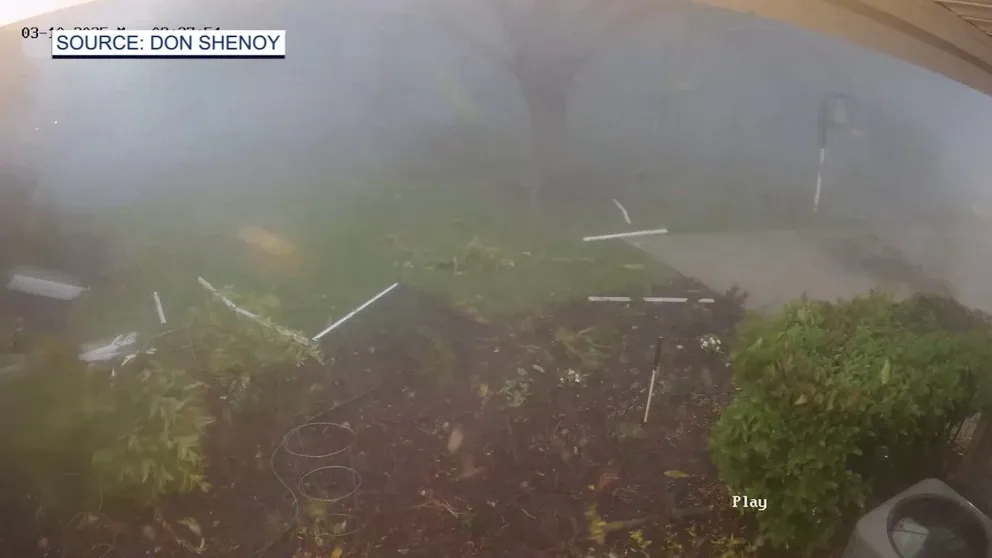
Security camera caught video of a tornado passing over a home in Longwood, Florida. The National Weather service said the twister was on the ground for four miles (Video Credit: Don Shenoy).
Before you go
Here are a few more stories you might find interesting.
Need more weather? Check your local forecast plus 3D radar in the FOX Weather app. You can also watch FOX Weather wherever you go using the FOX Weather app, at FOXWeather.com/live or on your favorite streaming service.
https://images.foxweather.com/static.foxweather.com/www.foxweather.com/content/uploads/2025/03/1024/512/gettyimages-1410222420-1.jpg?ve=1&tl=1
2025-03-12 11:26:05


