
Severe storms rumble into the South to kick off the weekend
3 min read
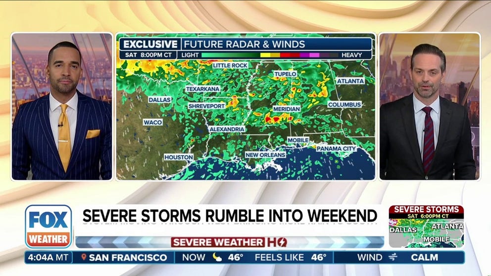
Large hail and isolated tornadoes are possible along the Gulf Coast Saturday and into the Florida Panhandle on Sunday as a storm system sweeps across the South.
NEW ORLEANS — A storm system sweeping across the South is kicking off a severe weather threat for much of the Gulf Coast Saturday, with potential for a full weekend washout along parts of northern Florida and Georgia.
Soaking rains and severe thunderstorm possibilities are courtesy of the storm system intensifying during the day and tapping into rich moisture streaming north from the nearby Gulf.

(FOX Weather)
With cold air aloft and strong updrafts, large hail looks to be the primary threat of any severe thunderstorms that develop.
Meanwhile, forecasts indicate there will be sufficient wind shear, allowing storms to rotate, generating a chance for a few tornadoes to develop along the leading edge of the storm near the low pressure center as it treks along eastern Texas and the Gulf Coast.
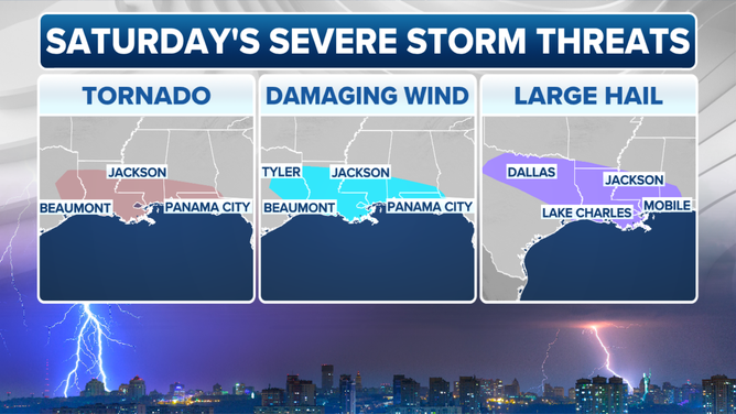
Saturday’s severe weather threats
(FOX Weather)
NOAA’s Storm Prediction Center so far has placed over 18 million inside the day’s primary threat of severe weather, stretching from Dallas through New Orleans and Jackson, Mississippi and the Florida Panhandle.
The overall threat level is low, garnering just a level 1 on the SPC’s 5-point severe weather scale, but any severe storms can cause damage or impacts. What’s worse, these storms are threatening some of the same areas that were just hit by tornadoes this past week.
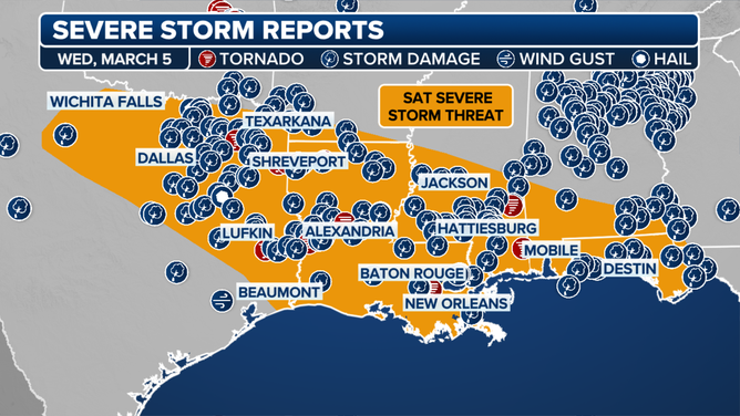
Saturday’s severe weather threat along the Gulf Coast marked with the severe weather reports from the severe weather outbreak on March 3-5.
(FOX Weather)
Outside the severe storms, flash flooding will be possible, especially in Florida and Southeastern Georgia with a wide swath of rain totals reaching 2-3 inches.
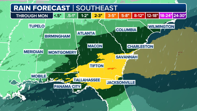
Total rain forecast across the Southeast for March 8-9, 2025.
(FOX Weather)
More rain and storms are possible there Sunday as the system moves east across Florida, and a level 1 threat of severe weather covers much of the Florida Panhandle and southern Georgia.
Jacksonville, Florida is sitting about 2 inches above average for year-to-date rain, so any additional rain will just add to the surplus, according to the FOX Forecast Center.
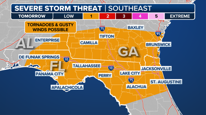
Sunday Severe Outlook
(FOX Weather)
Two hours to the north, Savannah, Georgia is sitting about 2 inches behind their normal average year-to-date rain.
More daunting severe weather threat looms across Southeast next week
While this weekend’s stormy weather rates relatively low on the severe weather risk scale, the FOX Forecast Center is casting a weary eye on the forecast across the South for the middle of next week as conditions appear ripe for a more dangerous severe weather outbreak.
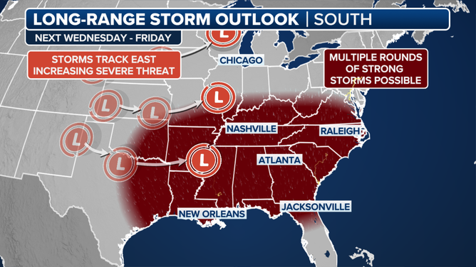
Next week’s severe weather threat in Southeast
(FOX Weather)
Two separate disturbances will eject out of the Rockies and move across the southern Plains and Southeast. The first one, expected sometime around Wednesday into Wednesday night, could lead to thunderstorms, some of which may be severe.
A more substantial storm system will move out into the southern Plains and into the Southeast on Thursday into Friday.
While a strong wind field will provide plenty of dangerous wind shear, capable of fostering the development of rotating storms, questions remain regarding how much moisture will be left over the passage of the first system on Wednesday.
Details will become clearer as the days get closer and forecast models come into better agreement, but suffice to say stormy weather looks to return again next week.
https://images.foxweather.com/static.foxweather.com/www.foxweather.com/content/uploads/2024/09/1024/512/lightning_generic_4_getty.jpg?ve=1&tl=1
2025-03-08 10:58:47


