La Nina’s impacts were felt before NOAA declared pattern underway
3 min read
NOAA has declared a much-anticipated La Niña climate pattern to be underway, but the event is a bit unusual, as regions of the world have been experiencing La Niña-like conditions for months.
According to the agency, weather patterns across the U.S. and other parts of the world have resembled patterns from previous La Niña events since at least October. This includes rainy conditions over parts of the Pacific Northwest and Northern California, a rainy Ohio Valley, and a drier East Coast.
With a generally weak La Niña underway, conditions aren’t expected to dramatically change around the globe.
“It’s very likely this La Niña will be weak, with the Niño-3.4 index unlikely to reach -1.0 °C for a season. This is based on computer model guidance and how late in the year La Niña conditions emerged. ENSO events peak in the Northern Hemisphere winter, and there’s just not a lot of time for La Niña to strengthen,” NOAA forecasters stated.

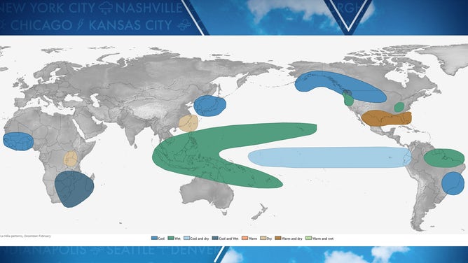
Typical global impacts of La Nina
(NOAA / FOX Weather)
LA NIÑA CLIMATE PATTERN OFFICIALLY ARRIVES AND IS EXPECTED TO PERSIST THROUGH WINTER
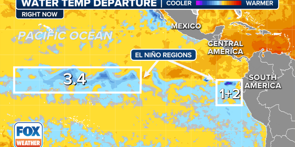
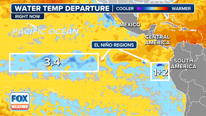
La Niña is considered to be the cool phase of the El Niño-Southern Oscillation (ENSO) and is characterized by lower-than-average sea-surface temperatures, with anomalies of at least -0.5 degrees Celsius over critical parts of the central and eastern Pacific.
Satellite data showed the current event is slightly below the needed threshold, thus triggering NOAA to declare a La Niña to be underway.
An average La Niña event typically lasts between 8 and 12 months, though it can extend well beyond a year.
The expected length of the current cool cycle of the ENSO is another uncharacteristic feature, with its length expected to last only a few short months. Long-term climate models show the world could exit the La Niña event as early as February, but more likely during the spring.
This would mean neutral conditions will likely become dominant again for much of 2025 as the planet decides on which direction it wants to go.

La Nina Pacific SST
(FOX Weather)
LITTLE-KNOWN WEATHER PATTERN WHEN EL NIÑO AND LA NIÑA ARE NO LONGER IN CONTROL
So why did La Niña-like conditions emerge before the actual event, and why isn’t the ENSO following normal patterns?
“The short answer to this is ‘we don’t yet know.’ The emergence of La Niña-like atmospheric conditions before substantial tropical Pacific Ocean surface cooling was unusual, though. The global oceans have been running much, much warmer than average for more than a year, which might have had a hand in La Niña’s delay. When we calculate the Niño-3.4 index but account for the temperature of the tropical oceans, we get an index that’s been in La Niña territory for months. Only this past year or so has the difference between the traditional and relative Niño-3.4 indexes been so large, and we’re still researching this new measurement and all the implications for ENSO development and impacts in a warmer world,” NOAA forecasters stated in a monthly blog.
In other words, climate change may be playing a larger role than acknowledged, but until scientists have years and possibly decades of data to examine and compare it to the ENSO state, don’t expect concrete answers as to why weather patterns don’t line up with previous norms.
The official designations by NOAA of “La Niña” and “El Niño” haven’t been around long, with widespread usage only dating back to the 1980s.
https://images.foxweather.com/static.foxweather.com/www.foxweather.com/content/uploads/2024/10/1024/512/sst-october-2024.png?ve=1&tl=1
2025-01-11 04:37:21


