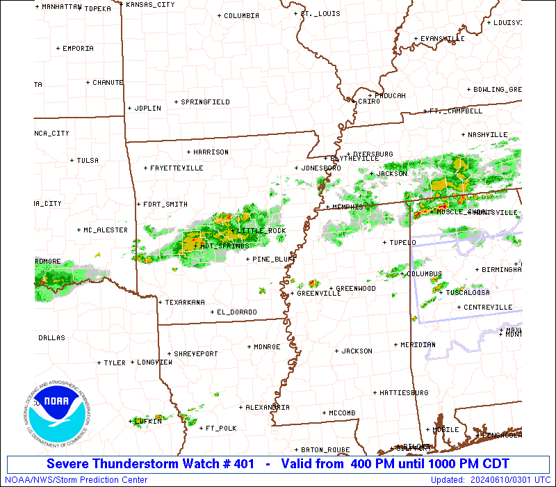
Storm Prediction Center Severe Thunderstorm Watch 401
7 min read
5 months ago
Note:
The expiration time in the watch graphic is amended if the watch is
replaced, cancelled or extended. Note: Click for Watch Status Reports.
   SEL1

   URGENT - IMMEDIATE BROADCAST REQUESTED
   Severe Thunderstorm Watch Number 401
   NWS Storm Prediction Center Norman OK
   245 PM EDT Mon Jun 9 2025

   The NWS Storm Prediction Center has issued a

   * Severe Thunderstorm Watch for portions of
     Far Southwest New York
     Central and Eastern Ohio
     Western Pennsylvania
     Northern West Virginia
     Lake Erie

   * Effective this Monday afternoon and evening from 245 PM until
     1000 PM EDT.

   * Primary threats include...
     Scattered damaging wind gusts to 70 mph possible
     Isolated large hail events to 1.5 inches in diameter possible

   SUMMARY...Thunderstorm coverage is expected to increase across the
   region this afternoon and evening, with multiple rounds of storms
   possible. Bowing line segments capable of damaging gusts are the
   primary risk, but isolated hail may occur as well.

   The severe thunderstorm watch area is approximately along and 90
   statute miles east and west of a line from 25 miles east northeast
   of Jamestown NY to 35 miles south southeast of Parkersburg WV. For a
   complete depiction of the watch see the associated watch outline
   update (WOUS64 KWNS WOU1).

   PRECAUTIONARY/PREPAREDNESS ACTIONS...

   REMEMBER...A Severe Thunderstorm Watch means conditions are
   favorable for severe thunderstorms in and close to the watch area.
   Persons in these areas should be on the lookout for threatening
   weather conditions and listen for later statements and possible
   warnings. Severe thunderstorms can and occasionally do produce
   tornadoes.

   &&

   AVIATION...A few severe thunderstorms with hail surface and aloft to
   1.5 inches. Extreme turbulence and surface wind gusts to 60 knots. A
   few cumulonimbi with maximum tops to 500. Mean storm motion vector
   24035.

   ...Mosier
Note:
The Aviation Watch (SAW) product is an approximation to the watch area.
The actual watch is depicted by the shaded areas.
   SAW1
   WW 401 SEVERE TSTM NY OH PA WV LE 091845Z - 100200Z
   AXIS..90 STATUTE MILES EAST AND WEST OF LINE..
   25ENE JHW/JAMESTOWN NY/ - 35SSE PKB/PARKERSBURG WV/
   ..AVIATION COORDS.. 80NM E/W /15ENE JHW - 41ENE HNN/
   HAIL SURFACE AND ALOFT..1.5 INCHES. WIND GUSTS..60 KNOTS.
   MAX TOPS TO 500. MEAN STORM MOTION VECTOR 24035.

   LAT...LON 42277704 38877951 38878285 42278056

   THIS IS AN APPROXIMATION TO THE WATCH AREA.  FOR A
   COMPLETE DEPICTION OF THE WATCH SEE WOUS64 KWNS
   FOR WOU1.
Watch 401 Status Report Messages:
STATUS REPORT #4 ON WW 401

VALID 092345Z - 100040Z

SEVERE WEATHER THREAT CONTINUES RIGHT OF A LINE FROM 10 W EKN TO
15 NW MGW TO 40 NE BFD.

..SPC..06/09/25

ATTN...WFO...BUF...CLE...RLX...PBZ...ILN...CTP...

&&

STATUS REPORT FOR WS 401

SEVERE WEATHER THREAT CONTINUES FOR THE FOLLOWING AREAS

PAC005-013-021-023-027-033-035-047-051-059-061-063-065-067-081-
083-087-105-111-117-123-129-100040-

PA
.    PENNSYLVANIA COUNTIES INCLUDED ARE

ARMSTRONG	     BLAIR		 CAMBRIA
CAMERON 	     CENTRE		 CLEARFIELD
CLINTON 	     ELK		 FAYETTE
GREENE		     HUNTINGDON 	 INDIANA
JEFFERSON	     JUNIATA		 LYCOMING
MCKEAN		     MIFFLIN		 POTTER
SOMERSET	     TIOGA		 WARREN
WESTMORELAND
$$


THE WATCH STATUS MESSAGE IS FOR GUIDANCE PURPOSES ONLY.  PLEASE
REFER TO WATCH COUNTY NOTIFICATION STATEMENTS FOR OFFICIAL
INFORMATION ON COUNTIES...INDEPENDENT CITIES AND MARINE ZONES
CLEARED FROM SEVERE THUNDERSTORM AND TORNADO WATCHES.
$$

STATUS REPORT #3 ON WW 401

VALID 092230Z - 092340Z

SEVERE WEATHER THREAT CONTINUES RIGHT OF A LINE FROM 35 SSW PKB
TO 30 NE PIT TO 10 ENE FKL TO 20 NE ERI.

..SPC..06/09/25

ATTN...WFO...BUF...CLE...RLX...PBZ...ILN...CTP...

&&

STATUS REPORT FOR WS 401

SEVERE WEATHER THREAT CONTINUES FOR THE FOLLOWING AREAS

NYC003-009-013-092340-

NY
.    NEW YORK COUNTIES INCLUDED ARE

ALLEGANY	     CATTARAUGUS	 CHAUTAUQUA
$$


PAC003-005-007-019-023-031-047-049-051-053-059-063-065-083-105-
121-123-125-129-092340-

PA
.    PENNSYLVANIA COUNTIES INCLUDED ARE

ALLEGHENY	     ARMSTRONG		 BEAVER
BUTLER		     CAMERON		 CLARION
ELK		     ERIE		 FAYETTE
FOREST		     GREENE		 INDIANA
JEFFERSON	     MCKEAN		 POTTER
VENANGO 	     WARREN		 WASHINGTON
WESTMORELAND
$$


WVC001-009-013-017-021-033-035-041-049-051-061-069-073-085-087-
091-095-097-103-105-107-092340-

WV
.    WEST VIRGINIA COUNTIES INCLUDED ARE

BARBOUR 	     BROOKE		 CALHOUN
DODDRIDGE	     GILMER		 HARRISON
JACKSON 	     LEWIS		 MARION
MARSHALL	     MONONGALIA 	 OHIO
PLEASANTS	     RITCHIE		 ROANE
TAYLOR		     TYLER		 UPSHUR
WETZEL		     WIRT		 WOOD
$$


LEZ040-092340-

CW

.    ADJACENT COASTAL WATERS INCLUDED ARE

RIPLEY TO DUNKIRK NY

$$
THE WATCH STATUS MESSAGE IS FOR GUIDANCE PURPOSES ONLY.  PLEASE
REFER TO WATCH COUNTY NOTIFICATION STATEMENTS FOR OFFICIAL
INFORMATION ON COUNTIES...INDEPENDENT CITIES AND MARINE ZONES
CLEARED FROM SEVERE THUNDERSTORM AND TORNADO WATCHES.
$$

STATUS REPORT #2 ON WW 401

VALID 092120Z - 092240Z

THE SEVERE WEATHER THREAT CONTINUES ACROSS THE ENTIRE WATCH AREA.

..SPC..06/09/25

ATTN...WFO...BUF...CLE...RLX...PBZ...ILN...CTP...

&&

STATUS REPORT FOR WS 401

SEVERE WEATHER THREAT CONTINUES FOR THE FOLLOWING AREAS

NYC003-009-013-092240-

NY
.    NEW YORK COUNTIES INCLUDED ARE

ALLEGANY	     CATTARAUGUS	 CHAUTAUQUA
$$


OHC007-009-013-019-029-031-053-059-067-079-081-087-099-105-111-
115-119-121-127-133-151-155-157-163-167-092240-

OH
.    OHIO COUNTIES INCLUDED ARE

ASHTABULA	     ATHENS		 BELMONT
CARROLL 	     COLUMBIANA 	 COSHOCTON
GALLIA		     GUERNSEY		 HARRISON
JACKSON 	     JEFFERSON		 LAWRENCE
MAHONING	     MEIGS		 MONROE
MORGAN		     MUSKINGUM		 NOBLE
PERRY		     PORTAGE		 STARK
TRUMBULL	     TUSCARAWAS 	 VINTON
WASHINGTON
$$


PAC003-005-007-019-023-031-039-047-049-053-059-065-073-083-085-
105-121-123-125-092240-

PA
.    PENNSYLVANIA COUNTIES INCLUDED ARE

ALLEGHENY	     ARMSTRONG		 BEAVER
BUTLER		     CAMERON		 CLARION
CRAWFORD	     ELK		 ERIE
FOREST		     GREENE		 JEFFERSON
LAWRENCE	     MCKEAN		 MERCER
POTTER		     VENANGO		 WARREN
WASHINGTON
$$


WVC001-009-013-017-021-029-033-035-041-051-053-069-073-085-087-
091-095-097-103-105-107-092240-

WV
.    WEST VIRGINIA COUNTIES INCLUDED ARE

BARBOUR 	     BROOKE		 CALHOUN
DODDRIDGE	     GILMER		 HANCOCK
HARRISON	     JACKSON		 LEWIS
MARSHALL	     MASON		 OHIO
PLEASANTS	     RITCHIE		 ROANE
TAYLOR		     TYLER		 UPSHUR
WETZEL		     WIRT		 WOOD
$$


LEZ040-148-149-092240-

CW

.    ADJACENT COASTAL WATERS INCLUDED ARE

RIPLEY TO DUNKIRK NY

GENEVA-ON-THE-LAKE TO CONNEAUT OH

CONNEAUT OH TO RIPLEY NY

$$
THE WATCH STATUS MESSAGE IS FOR GUIDANCE PURPOSES ONLY.  PLEASE
REFER TO WATCH COUNTY NOTIFICATION STATEMENTS FOR OFFICIAL
INFORMATION ON COUNTIES...INDEPENDENT CITIES AND MARINE ZONES
CLEARED FROM SEVERE THUNDERSTORM AND TORNADO WATCHES.
$$

STATUS REPORT #1 ON WW 401

VALID 092055Z - 092140Z

SEVERE WEATHER THREAT CONTINUES RIGHT OF A LINE FROM 35 WNW HTS
TO 15 NNW ZZV TO 35 NNW YNG TO 40 W ERI.

FOR ADDITIONAL INFORMATION SEE MESOSCALE DISCUSSION 1228

..THORNTON..06/09/25

ATTN...WFO...BUF...CLE...RLX...PBZ...ILN...CTP...

&&

STATUS REPORT FOR WS 401

SEVERE WEATHER THREAT CONTINUES FOR THE FOLLOWING AREAS

MIC037-092140-

MI
.    MICHIGAN COUNTIES INCLUDED ARE

CLINTON
$$


NYC003-009-013-092140-

NY
.    NEW YORK COUNTIES INCLUDED ARE

ALLEGANY	     CATTARAUGUS	 CHAUTAUQUA
$$


OHC007-009-013-019-029-031-053-059-067-079-081-087-099-105-111-
115-119-121-127-133-151-155-157-163-167-092140-

OH
.    OHIO COUNTIES INCLUDED ARE

ASHTABULA	     ATHENS		 BELMONT
CARROLL 	     COLUMBIANA 	 COSHOCTON
GALLIA		     GUERNSEY		 HARRISON
JACKSON 	     JEFFERSON		 LAWRENCE
MAHONING	     MEIGS		 MONROE
MORGAN		     MUSKINGUM		 NOBLE
PERRY		     PORTAGE		 STARK
TRUMBULL	     TUSCARAWAS 	 VINTON
WASHINGTON
$$


PAC003-005-007-019-023-031-039-047-049-053-059-065-073-083-085-
105-121-123-125-092140-

PA
.    PENNSYLVANIA COUNTIES INCLUDED ARE

ALLEGHENY	     ARMSTRONG		 BEAVER
BUTLER		     CAMERON		 CLARION
CRAWFORD	     ELK		 ERIE
FOREST		     GREENE		 JEFFERSON
LAWRENCE	     MCKEAN		 MERCER
POTTER		     VENANGO		 WARREN
WASHINGTON
$$


WVC001-009-013-017-021-029-033-035-041-051-053-069-073-085-087-
091-095-097-103-105-107-092140-

WV
.    WEST VIRGINIA COUNTIES INCLUDED ARE

BARBOUR 	     BROOKE		 CALHOUN
DODDRIDGE	     GILMER		 HANCOCK
HARRISON	     JACKSON		 LEWIS
MARSHALL	     MASON		 OHIO
PLEASANTS	     RITCHIE		 ROANE
TAYLOR		     TYLER		 UPSHUR
WETZEL		     WIRT		 WOOD
$$


LEZ040-148-149-092140-

CW

.    ADJACENT COASTAL WATERS INCLUDED ARE

RIPLEY TO DUNKIRK NY

GENEVA-ON-THE-LAKE TO CONNEAUT OH

CONNEAUT OH TO RIPLEY NY

$$
THE WATCH STATUS MESSAGE IS FOR GUIDANCE PURPOSES ONLY.  PLEASE
REFER TO WATCH COUNTY NOTIFICATION STATEMENTS FOR OFFICIAL
INFORMATION ON COUNTIES...INDEPENDENT CITIES AND MARINE ZONES
CLEARED FROM SEVERE THUNDERSTORM AND TORNADO WATCHES.
$$
Probability of 1 or more strong (EF2-EF5) tornadoes
Low (<2%)
Wind
Probability of 10 or more severe wind events
Mod (40%)
Probability of 1 or more wind events > 65 knots
Low (20%)
Hail
Probability of 10 or more severe hail events
Low (20%)
Probability of 1 or more hailstones > 2 inches
Low (10%)
Combined Severe Hail/Wind
Probability of 6 or more combined severe hail/wind events
Mod (60%)
For each watch, probabilities for particular events inside the watch
(listed above in each table) are determined by the issuing forecaster.
The “Low” category contains probability values ranging from less than 2%
to 20% (EF2-EF5 tornadoes), less than 5% to 20% (all other probabilities),
“Moderate” from 30% to 60%, and “High” from 70% to greater than 95%.
High values are bolded and lighter in color to provide awareness of
an increased threat for a particular event.