Note:
The expiration time in the watch graphic is amended if the watch is
replaced, cancelled or extended. Note: Click for Watch Status Reports.
SEL8
URGENT - IMMEDIATE BROADCAST REQUESTED
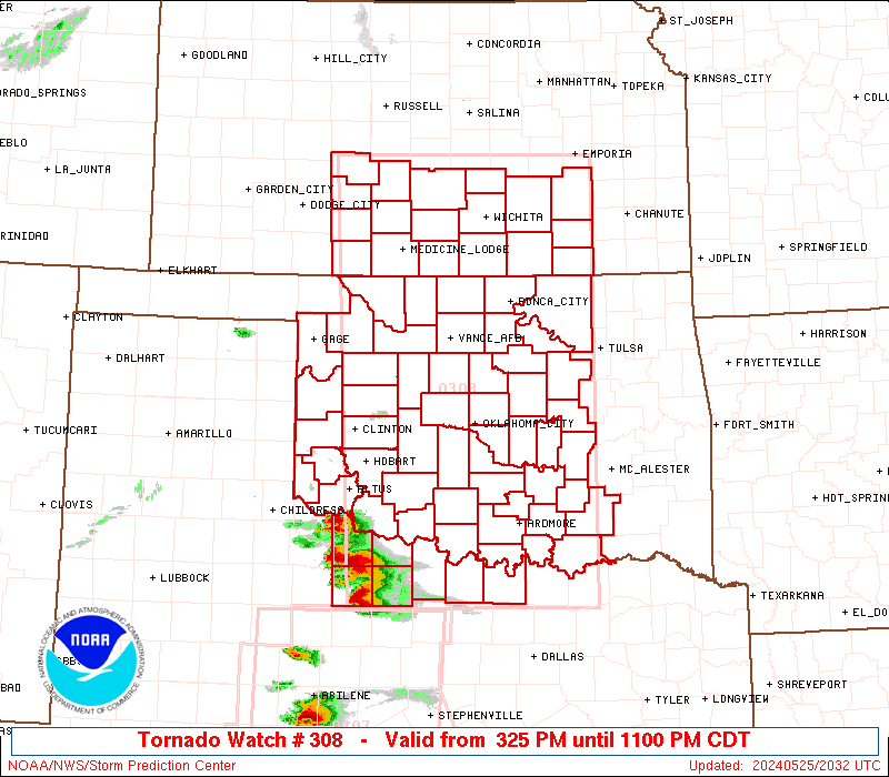
Tornado Watch Number 308
NWS Storm Prediction Center Norman OK
725 PM EDT Tue May 20 2025
The NWS Storm Prediction Center has issued a
* Tornado Watch for portions of
Northern Georgia
Eastern Kentucky
Far Southwest North Carolina
Eastern Tennessee
Far Southwest Virginia
* Effective this Tuesday night and Wednesday morning from 725 PM
until 200 AM EDT.
* Primary threats include...
A few tornadoes likely with a couple intense tornadoes possible
Scattered damaging wind gusts to 70 mph likely
Scattered large hail and isolated very large hail events to 2.5
inches in diameter possible
SUMMARY...A mix of supercell thunderstorms and clusters will spread
generally eastward this evening into the early overnight hours. A
few tornadoes may occur with this activity, and a strong tornado and
isolated very large hail will also be possible with any sustained
supercell. Otherwise, an increasing threat for scattered to numerous
damaging winds appears likely as thunderstorms attempt to organize
into a line later this evening. Peak gusts may reach up to 60-70
mph.
The tornado watch area is approximately along and 50 statute miles
east and west of a line from 35 miles north northeast of London KY
to 20 miles southeast of Rome GA. For a complete depiction of the
watch see the associated watch outline update (WOUS64 KWNS WOU8).
PRECAUTIONARY/PREPAREDNESS ACTIONS...
REMEMBER...A Tornado Watch means conditions are favorable for
tornadoes and severe thunderstorms in and close to the watch
area. Persons in these areas should be on the lookout for
threatening weather conditions and listen for later statements
and possible warnings.
&&
OTHER WATCH INFORMATION...CONTINUE...WW 303...WW 304...WW
305...WW 306...WW 307...
AVIATION...Tornadoes and a few severe thunderstorms with hail
surface and aloft to 2.5 inches. Extreme turbulence and surface wind
gusts to 60 knots. A few cumulonimbi with maximum tops to 550. Mean
storm motion vector 26030.
...Gleason
   SEL8

   URGENT - IMMEDIATE BROADCAST REQUESTED
   Tornado Watch Number 308
   NWS Storm Prediction Center Norman OK
   725 PM EDT Tue May 20 2025

   The NWS Storm Prediction Center has issued a

   * Tornado Watch for portions of
     Northern Georgia
     Eastern Kentucky
     Far Southwest North Carolina
     Eastern Tennessee
     Far Southwest Virginia

   * Effective this Tuesday night and Wednesday morning from 725 PM
     until 200 AM EDT.

   * Primary threats include...
     A few tornadoes likely with a couple intense tornadoes possible
     Scattered damaging wind gusts to 70 mph likely
     Scattered large hail and isolated very large hail events to 2.5
       inches in diameter possible

   SUMMARY...A mix of supercell thunderstorms and clusters will spread
   generally eastward this evening into the early overnight hours. A
   few tornadoes may occur with this activity, and a strong tornado and
   isolated very large hail will also be possible with any sustained
   supercell. Otherwise, an increasing threat for scattered to numerous
   damaging winds appears likely as thunderstorms attempt to organize
   into a line later this evening. Peak gusts may reach up to 60-70
   mph.

   The tornado watch area is approximately along and 50 statute miles
   east and west of a line from 35 miles north northeast of London KY
   to 20 miles southeast of Rome GA. For a complete depiction of the
   watch see the associated watch outline update (WOUS64 KWNS WOU8).

   PRECAUTIONARY/PREPAREDNESS ACTIONS...

   REMEMBER...A Tornado Watch means conditions are favorable for
   tornadoes and severe thunderstorms in and close to the watch
   area. Persons in these areas should be on the lookout for
   threatening weather conditions and listen for later statements
   and possible warnings.

   &&

   OTHER WATCH INFORMATION...CONTINUE...WW 303...WW 304...WW
   305...WW 306...WW 307...

   AVIATION...Tornadoes and a few severe thunderstorms with hail
   surface and aloft to 2.5 inches. Extreme turbulence and surface wind
   gusts to 60 knots. A few cumulonimbi with maximum tops to 550. Mean
   storm motion vector 26030.

   ...Gleason
Note:
The Aviation Watch (SAW) product is an approximation to the watch area.
The actual watch is depicted by the shaded areas.
   SAW8
   WW 308 TORNADO GA KY NC TN VA 202325Z - 210600Z
   AXIS..50 STATUTE MILES EAST AND WEST OF LINE..
   35NNE LOZ/LONDON KY/ - 20SE RMG/ROME GA/
   ..AVIATION COORDS.. 45NM E/W /34NNE LOZ - 39NW ATL/
   HAIL SURFACE AND ALOFT..2.5 INCHES. WIND GUSTS..60 KNOTS.
   MAX TOPS TO 550. MEAN STORM MOTION VECTOR 26030.

   LAT...LON 37548292 34148405 34148580 37548475

   THIS IS AN APPROXIMATION TO THE WATCH AREA.  FOR A
   COMPLETE DEPICTION OF THE WATCH SEE WOUS64 KWNS
   FOR WOU8.
Watch 308 Status Report Messages:
STATUS REPORT #5 ON WW 308

VALID 210340Z - 210440Z

SEVERE WEATHER THREAT CONTINUES RIGHT OF A LINE FROM 35 W RMG TO
40 S TYS TO 40 SE LOZ TO 10 NNE JKL.

..BROYLES..05/21/25

ATTN...WFO...FFC...JKL...MRX...

&&

STATUS REPORT FOR WT 308

SEVERE WEATHER THREAT CONTINUES FOR THE FOLLOWING AREAS

GAC015-055-057-085-111-115-117-123-129-143-187-213-223-227-233-
291-313-210440-

GA
.    GEORGIA COUNTIES INCLUDED ARE

BARTOW		     CHATTOOGA		 CHEROKEE
DAWSON		     FANNIN		 FLOYD
FORSYTH 	     GILMER		 GORDON
HARALSON	     LUMPKIN		 MURRAY
PAULDING	     PICKENS		 POLK
UNION		     WHITFIELD
$$


KYC025-051-095-119-131-133-193-210440-

KY
.    KENTUCKY COUNTIES INCLUDED ARE

BREATHITT	     CLAY		 HARLAN
KNOTT		     LESLIE		 LETCHER
PERRY
$$


NCC039-210440-

NC
.    NORTH CAROLINA COUNTIES INCLUDED ARE

CHEROKEE
$$


TNC009-057-063-067-089-155-210440-

TN
.    TENNESSEE COUNTIES INCLUDED ARE

BLOUNT		     GRAINGER		 HAMBLEN
HANCOCK 	     JEFFERSON		 SEVIER
$$


VAC105-210440-

VA
.    VIRGINIA COUNTIES INCLUDED ARE

LEE
$$


THE WATCH STATUS MESSAGE IS FOR GUIDANCE PURPOSES ONLY.  PLEASE
REFER TO WATCH COUNTY NOTIFICATION STATEMENTS FOR OFFICIAL
INFORMATION ON COUNTIES...INDEPENDENT CITIES AND MARINE ZONES
CLEARED FROM SEVERE THUNDERSTORM AND TORNADO WATCHES.
$$

STATUS REPORT #4 ON WW 308

VALID 210235Z - 210340Z

SEVERE WEATHER THREAT CONTINUES RIGHT OF A LINE FROM 25 ESE HSV
TO 20 E CHA TO 40 S LOZ TO 20 N JKL.

..BROYLES..05/21/25

ATTN...WFO...FFC...JKL...MRX...

&&

STATUS REPORT FOR WT 308

SEVERE WEATHER THREAT CONTINUES FOR THE FOLLOWING AREAS

GAC015-047-055-057-085-111-115-117-123-129-143-187-213-223-227-
233-291-295-313-210340-

GA
.    GEORGIA COUNTIES INCLUDED ARE

BARTOW		     CATOOSA		 CHATTOOGA
CHEROKEE	     DAWSON		 FANNIN
FLOYD		     FORSYTH		 GILMER
GORDON		     HARALSON		 LUMPKIN
MURRAY		     PAULDING		 PICKENS
POLK		     UNION		 WALKER
WHITFIELD
$$


KYC013-025-051-095-119-121-129-131-133-189-193-197-237-210340-

KY
.    KENTUCKY COUNTIES INCLUDED ARE

BELL		     BREATHITT		 CLAY
HARLAN		     KNOTT		 KNOX
LEE		     LESLIE		 LETCHER
OWSLEY		     PERRY		 POWELL
WOLFE
$$


NCC039-210340-

NC
.    NORTH CAROLINA COUNTIES INCLUDED ARE

CHEROKEE
$$


TNC001-009-025-057-063-067-089-093-105-123-139-155-173-210340-

TN
.    TENNESSEE COUNTIES INCLUDED ARE

ANDERSON	     BLOUNT		 CLAIBORNE
GRAINGER	     HAMBLEN		 HANCOCK
JEFFERSON	     KNOX		 LOUDON
MONROE		     POLK		 SEVIER
UNION
$$


VAC105-210340-

VA
.    VIRGINIA COUNTIES INCLUDED ARE

LEE
$$


THE WATCH STATUS MESSAGE IS FOR GUIDANCE PURPOSES ONLY.  PLEASE
REFER TO WATCH COUNTY NOTIFICATION STATEMENTS FOR OFFICIAL
INFORMATION ON COUNTIES...INDEPENDENT CITIES AND MARINE ZONES
CLEARED FROM SEVERE THUNDERSTORM AND TORNADO WATCHES.
$$

STATUS REPORT #3 ON WW 308

VALID 210135Z - 210240Z

THE SEVERE WEATHER THREAT CONTINUES ACROSS THE ENTIRE WATCH AREA.

..BROYLES..05/21/25

ATTN...WFO...FFC...JKL...MRX...

&&

STATUS REPORT FOR WT 308

SEVERE WEATHER THREAT CONTINUES FOR THE FOLLOWING AREAS

GAC015-047-055-057-083-085-111-115-117-123-129-187-213-227-291-
295-313-210240-

GA
.    GEORGIA COUNTIES INCLUDED ARE

BARTOW		     CATOOSA		 CHATTOOGA
CHEROKEE	     DADE		 DAWSON
FANNIN		     FLOYD		 FORSYTH
GILMER		     GORDON		 LUMPKIN
MURRAY		     PICKENS		 UNION
WALKER		     WHITFIELD
$$


KYC013-025-051-095-109-119-121-125-131-133-147-189-193-199-203-
235-210240-

KY
.    KENTUCKY COUNTIES INCLUDED ARE

BELL		     BREATHITT		 CLAY
HARLAN		     JACKSON		 KNOTT
KNOX		     LAUREL		 LESLIE
LETCHER 	     MCCREARY		 OWSLEY
PERRY		     PULASKI		 ROCKCASTLE
WHITLEY
$$


NCC039-210240-

NC
.    NORTH CAROLINA COUNTIES INCLUDED ARE

CHEROKEE
$$


TNC001-009-011-013-025-057-063-065-067-089-093-105-107-121-123-
129-139-143-145-151-155-173-210240-

TN
.    TENNESSEE COUNTIES INCLUDED ARE

ANDERSON	     BLOUNT		 BRADLEY
CAMPBELL	     CLAIBORNE		 GRAINGER
HAMBLEN 	     HAMILTON		 HANCOCK
JEFFERSON	     KNOX		 LOUDON
MCMINN		     MEIGS		 MONROE
MORGAN		     POLK		 RHEA
ROANE		     SCOTT		 SEVIER
UNION
$$


VAC105-210240-

VA
.    VIRGINIA COUNTIES INCLUDED ARE

LEE
$$


THE WATCH STATUS MESSAGE IS FOR GUIDANCE PURPOSES ONLY.  PLEASE
REFER TO WATCH COUNTY NOTIFICATION STATEMENTS FOR OFFICIAL
INFORMATION ON COUNTIES...INDEPENDENT CITIES AND MARINE ZONES
CLEARED FROM SEVERE THUNDERSTORM AND TORNADO WATCHES.
$$

STATUS REPORT #2 ON WW 308

VALID 210040Z - 210140Z

THE SEVERE WEATHER THREAT CONTINUES ACROSS THE ENTIRE WATCH AREA.

..BROYLES..05/21/25

ATTN...WFO...FFC...JKL...MRX...

&&

STATUS REPORT FOR WT 308

SEVERE WEATHER THREAT CONTINUES FOR THE FOLLOWING AREAS

GAC015-047-055-057-083-085-111-115-117-123-129-187-213-227-291-
295-313-210140-

GA
.    GEORGIA COUNTIES INCLUDED ARE

BARTOW		     CATOOSA		 CHATTOOGA
CHEROKEE	     DADE		 DAWSON
FANNIN		     FLOYD		 FORSYTH
GILMER		     GORDON		 LUMPKIN
MURRAY		     PICKENS		 UNION
WALKER		     WHITFIELD
$$


KYC013-025-051-095-109-119-121-125-131-133-147-189-193-199-203-
231-235-210140-

KY
.    KENTUCKY COUNTIES INCLUDED ARE

BELL		     BREATHITT		 CLAY
HARLAN		     JACKSON		 KNOTT
KNOX		     LAUREL		 LESLIE
LETCHER 	     MCCREARY		 OWSLEY
PERRY		     PULASKI		 ROCKCASTLE
WAYNE		     WHITLEY
$$


NCC039-210140-

NC
.    NORTH CAROLINA COUNTIES INCLUDED ARE

CHEROKEE
$$


TNC001-007-009-011-013-025-057-063-065-067-089-093-105-107-115-
121-123-129-139-143-145-151-153-155-173-210140-

TN
.    TENNESSEE COUNTIES INCLUDED ARE

ANDERSON	     BLEDSOE		 BLOUNT
BRADLEY 	     CAMPBELL		 CLAIBORNE
GRAINGER	     HAMBLEN		 HAMILTON
HANCOCK 	     JEFFERSON		 KNOX
LOUDON		     MCMINN		 MARION
MEIGS		     MONROE		 MORGAN
POLK		     RHEA		 ROANE
SCOTT		     SEQUATCHIE 	 SEVIER
UNION
$$


VAC105-210140-

VA
.    VIRGINIA COUNTIES INCLUDED ARE

LEE
$$


THE WATCH STATUS MESSAGE IS FOR GUIDANCE PURPOSES ONLY.  PLEASE
REFER TO WATCH COUNTY NOTIFICATION STATEMENTS FOR OFFICIAL
INFORMATION ON COUNTIES...INDEPENDENT CITIES AND MARINE ZONES
CLEARED FROM SEVERE THUNDERSTORM AND TORNADO WATCHES.
$$

STATUS REPORT #1 ON WW 308

VALID 202335Z - 210040Z

THE SEVERE WEATHER THREAT CONTINUES ACROSS THE ENTIRE WATCH AREA.

..BROYLES..05/20/25

ATTN...WFO...FFC...JKL...MRX...

&&

STATUS REPORT FOR WT 308

SEVERE WEATHER THREAT CONTINUES FOR THE FOLLOWING AREAS

GAC015-047-055-057-083-085-111-115-117-123-129-187-213-227-291-
295-313-210040-

GA
.    GEORGIA COUNTIES INCLUDED ARE

BARTOW		     CATOOSA		 CHATTOOGA
CHEROKEE	     DADE		 DAWSON
FANNIN		     FLOYD		 FORSYTH
GILMER		     GORDON		 LUMPKIN
MURRAY		     PICKENS		 UNION
WALKER		     WHITFIELD
$$


KYC013-025-051-095-109-119-121-125-131-133-147-189-193-199-203-
231-235-210040-

KY
.    KENTUCKY COUNTIES INCLUDED ARE

BELL		     BREATHITT		 CLAY
HARLAN		     JACKSON		 KNOTT
KNOX		     LAUREL		 LESLIE
LETCHER 	     MCCREARY		 OWSLEY
PERRY		     PULASKI		 ROCKCASTLE
WAYNE		     WHITLEY
$$


NCC039-210040-

NC
.    NORTH CAROLINA COUNTIES INCLUDED ARE

CHEROKEE
$$


TNC001-007-009-011-013-025-057-063-065-067-089-093-105-107-115-
121-123-129-139-143-145-151-153-155-173-210040-

TN
.    TENNESSEE COUNTIES INCLUDED ARE

ANDERSON	     BLEDSOE		 BLOUNT
BRADLEY 	     CAMPBELL		 CLAIBORNE
GRAINGER	     HAMBLEN		 HAMILTON
HANCOCK 	     JEFFERSON		 KNOX
LOUDON		     MCMINN		 MARION
MEIGS		     MONROE		 MORGAN
POLK		     RHEA		 ROANE
SCOTT		     SEQUATCHIE 	 SEVIER
UNION
$$


VAC105-210040-

VA
.    VIRGINIA COUNTIES INCLUDED ARE

LEE
$$


THE WATCH STATUS MESSAGE IS FOR GUIDANCE PURPOSES ONLY.  PLEASE
REFER TO WATCH COUNTY NOTIFICATION STATEMENTS FOR OFFICIAL
INFORMATION ON COUNTIES...INDEPENDENT CITIES AND MARINE ZONES
CLEARED FROM SEVERE THUNDERSTORM AND TORNADO WATCHES.
$$
Probability of 1 or more strong (EF2-EF5) tornadoes
Mod (40%)
Wind
Probability of 10 or more severe wind events
High (70%)
Probability of 1 or more wind events > 65 knots
Low (20%)
Hail
Probability of 10 or more severe hail events
Mod (40%)
Probability of 1 or more hailstones > 2 inches
Mod (40%)
Combined Severe Hail/Wind
Probability of 6 or more combined severe hail/wind events
High (80%)
For each watch, probabilities for particular events inside the watch
(listed above in each table) are determined by the issuing forecaster.
The “Low” category contains probability values ranging from less than 2%
to 20% (EF2-EF5 tornadoes), less than 5% to 20% (all other probabilities),
“Moderate” from 30% to 60%, and “High” from 70% to greater than 95%.
High values are bolded and lighter in color to provide awareness of
an increased threat for a particular event.