
Storm Prediction Center Mesoscale Discussion 893
1 min read|
|
| Mesoscale Discussion 893 | |
| < Previous MD | |
|
|
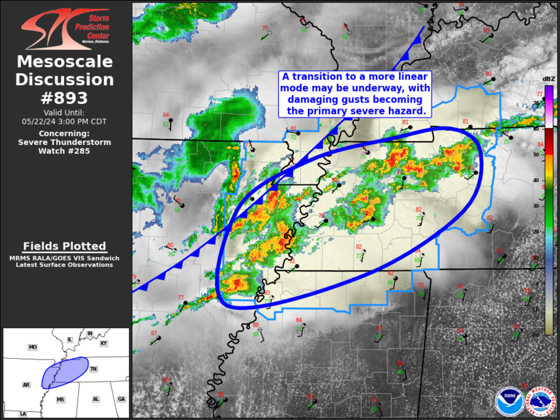
Mesoscale Discussion 0893 NWS Storm Prediction Center Norman OK 0804 PM CDT Mon May 19 2025 Areas affected...Parts of northwest Arkansas Concerning...Tornado Watch 297... Valid 200104Z - 200230Z The severe weather threat for Tornado Watch 297 continues. SUMMARY...The risk of tornadoes (some possibly strong) and damaging winds continues spreading eastward across parts of northwest Arkansas. DISCUSSION...A north/south-oriented MCS is tracking eastward across northwest Arkansas. Around 50 kt of 0-6 km shear (per area VWP data) is oriented oblique to the gust front of this system, which is supporting the maintenance of several deeper/embedded rotating updrafts -- aided by moderately unstable surface-based inflow (see LZK 00Z sounding). These embedded supercell/mesovortex structures will continue to pose a tornado risk (some possibly strong) with eastward extent -- given ample low-level streamwise vorticity (300 m2/s2 0-1km SRH sampled by LZK VWP). Damaging winds will also remain possible, especially in the vicinity of any supercells/mesovorticies. ..Weinman.. 05/20/2025 ...Please see www.spc.noaa.gov for graphic product... ATTN...WFO...LZK...TSA... LAT...LON 35079464 35849415 36379397 36449353 36449321 36309276 36059257 35209298 34949338 34909436 35079464 MOST PROBABLE PEAK TORNADO INTENSITY...120-150 MPH MOST PROBABLE PEAK WIND GUST...75-90 MPH MOST PROBABLE PEAK HAIL SIZE...1.50-2.50 IN |
|
|
Top/All Mesoscale Discussions/Forecast Products/Home |
|
2025-05-20 01:42:03
