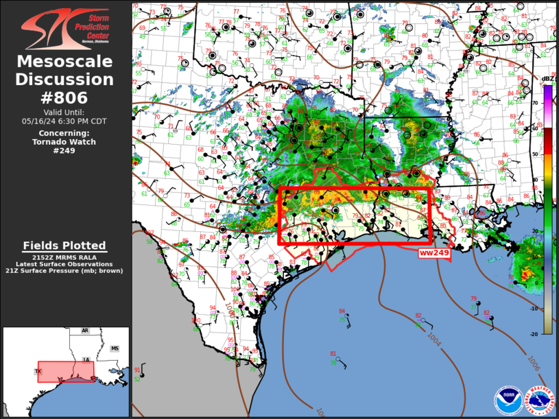
Storm Prediction Center Mesoscale Discussion 806
1 min read
|
|
 |
| Mesoscale Discussion 806 | |
| < Previous MD | |

|
|
Mesoscale Discussion 0806 NWS Storm Prediction Center Norman OK 0635 AM CDT Fri May 16 2025 Areas affected...northeast AR/southeast MO into parts of KY/TN...WV and western VA Concerning...Severe Thunderstorm Watch 259... Valid 161135Z - 161330Z The severe weather threat for Severe Thunderstorm Watch 259 continues. SUMMARY...Severe thunderstorms posing a risk for large to very large hail will persist across Severe Thunderstorm Watch 259. This activity may maintain severity downstream into eastern Kentucky and portions of West Virginia and western Virginia. A new watch may be needed to replace WW 259 and to expand downstream. DISCUSSION...Scattered severe thunderstorm clusters are ongoing this morning from northeast AR into central KY. This activity is occurring in a warm advection regime and on the fringes of an 850 mb southwesterly low-level jet. While some inhibition is present in the low-levels given the nocturnally cooled boundary layer, MUCAPE from 1000-2000 J/kg is in place amid a moist airmass. Elongated/straight supercell profiles and cool temperatures aloft also are present. Thus, a large hail threat will accompany any more discrete convection. Recent radar trends suggest clustering may be underway near the MO Bootheel and into western KY. If this continues, convection could develop into a small MCS and move across KY toward WV/VA, posing a risk for strong/severe wind gusts as well as the downstream airmass destabilizes and inhibition erodes later this morning as diurnal heating ensues. An isolated cell also is approaching the edge of WW 259 across central KY and a downstream watch and/or larger watch replacement may be needed soon. ..Leitman.. 05/16/2025 ...Please see www.spc.noaa.gov for graphic product... ATTN...WFO...RNK...RLX...MRX...JKL...ILN...LMK...OHX...PAH... MEG...LZK...SGF... LAT...LON 36099212 37318926 38118690 38378469 38378276 38018181 37338153 36908156 36618216 36488344 36098828 35479074 35229206 35259222 35619238 36099212 MOST PROBABLE PEAK TORNADO INTENSITY...UP TO 95 MPH MOST PROBABLE PEAK WIND GUST...55-70 MPH MOST PROBABLE PEAK HAIL SIZE...1.50-2.50 IN |
|
|
Top/All Mesoscale Discussions/Forecast Products/Home |
|
2025-05-16 12:02:03


