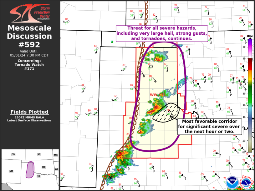
Storm Prediction Center Mesoscale Discussion 592
1 min read
|
|
 |
| Mesoscale Discussion 592 | |
| < Previous MD | |

|
|
Mesoscale Discussion 0592 NWS Storm Prediction Center Norman OK 0713 PM CDT Mon Apr 28 2025 Areas affected...Portions of northwest Texas Concerning...Tornado Watch 182... Valid 290013Z - 290145Z The severe weather threat for Tornado Watch 182 continues. SUMMARY...Supercells will continue to pose a risk of very large hail, with an increasing tornado risk into this evening (00-02Z). DISCUSSION...Semi-discrete supercell clusters are tracking northeastward across northwest Texas this evening. These storms are evolving east of a dryline bulge, where temperatures have warmed into the 80s amid upper 60s to around 70 dewpoints -- beneath steep midlevel lapse rates. Around 40 kt of deep-layer shear (per VWP data), characterized by a long/generally straight hodograph, should continue to favor a risk of very large hail. However, as the low-level jet increases over the next couple hours, clockwise-curved low-level hodographs should expand, favoring an increasing tornado risk -- especially as storms track northeastward toward the Red River through 02Z. Around of 300-400 m2/s2 effective SRH will conditionally support a strong tornado with any established right-moving supercells that evolve. ..Weinman.. 04/29/2025 ...Please see www.spc.noaa.gov for graphic product... ATTN...WFO...FWD...OUN...SJT...LUB... LAT...LON 32470016 32680034 33790018 34189991 34299959 34229923 34049892 33689885 33009895 32579931 32429964 32470016 MOST PROBABLE PEAK TORNADO INTENSITY...100-130 MPH MOST PROBABLE PEAK WIND GUST...65-80 MPH MOST PROBABLE PEAK HAIL SIZE...2.75-4.25 IN |
|
|
Top/All Mesoscale Discussions/Forecast Products/Home |
|
2025-04-29 00:26:02


