Storm Prediction Center Mesoscale Discussion 588
1 min read
|
|
 |
| Mesoscale Discussion 588 | |
| < Previous MD | |

|
|
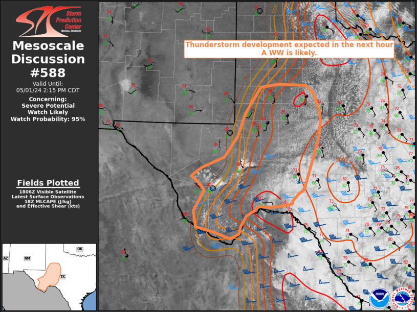
   Mesoscale Discussion 0588
   NWS Storm Prediction Center Norman OK
   0333 PM CDT Mon Apr 28 2025

   Areas affected...Edwards Plateau into western/central Oklahoma

   Concerning...Severe potential...Tornado Watch likely

   Valid 282033Z - 282300Z

   Probability of Watch Issuance...80 percent

   SUMMARY...A tornado watch will likely be needed this afternoon as
   storms are expected to develop along the dryline in the next 2-3
   hours. All severe hazards will be possible. The tornado threat will
   steadily increase from late afternoon into the evening.

   DISCUSSION...Signs of mid-level ascent have been evident across the
   southern Plains with visible satellite showing increasing amounts of
   mid/high-level clouds moving in from the southwest. As a shortwave
   perturbation lifts northeastward this afternoon/evening, this ascent
   and additional surface heating should erode capping along/near the
   dryline. A high-based storm has already formed northeast of Fort
   Stockton in the last hour. Additional storms are expected to develop
   later this afternoon, perhaps within the next 2-3 hours.

   The environment will be quite favorable for supercells capable of
   all severe hazards. Very steep mid-level lapse rates were observed
   within the High Plains region on this mornings soundings. Large to
   potentially giant hail will be possible along with severe winds.
   Tornadoes will also be possible, particularly from southwest
   Oklahoma into the Texas Rolling Plains where dewpoints have remained
   in the upper 60s/low 70s F. The tornado threat will steadily
   increase with time as 850 mb winds increase east of the dryline from
   late afternoon into the evening. A strong tornado cannot be ruled
   out within this more favorable mesoscale zone.

   ..Wendt/Hart.. 04/28/2025

   ...Please see www.spc.noaa.gov for graphic product...

   ATTN...WFO...FWD...OUN...SJT...LUB...MAF...

   LAT...LON   34040023 35719959 36229909 36769846 36809782 36069709
               35409708 34339724 33289797 32219946 32199957 31330088
               31160179 31200232 31550250 32450181 34040023

   MOST PROBABLE PEAK TORNADO INTENSITY...100-130 MPH
   MOST PROBABLE PEAK WIND GUST...65-80 MPH
   MOST PROBABLE PEAK HAIL SIZE...2.75-4.25 IN
|
|
|
Top/All Mesoscale Discussions/Forecast Products/Home |
|
2025-04-28 20:36:04


