Note:
The expiration time in the watch graphic is amended if the watch is
replaced, cancelled or extended. Note: Click for Watch Status Reports.
SEL5
URGENT - IMMEDIATE BROADCAST REQUESTED
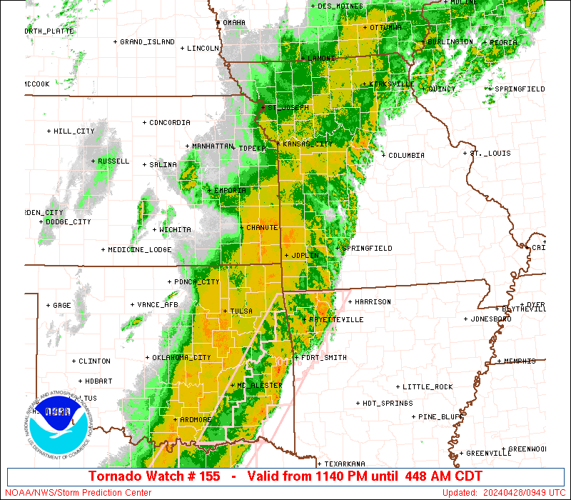
Tornado Watch Number 155
NWS Storm Prediction Center Norman OK
340 PM CDT Sun Apr 20 2025
The NWS Storm Prediction Center has issued a
* Tornado Watch for portions of
southeastern Iowa
western and centrl Illinois
far western Kentucky
eastern Missouri
* Effective this Sunday afternoon and evening from 340 PM until
1100 PM CDT.
* Primary threats include...
A few tornadoes and a couple intense tornadoes possible
Scattered damaging wind gusts to 70 mph likely
Scattered large hail events to 1.5 inches in diameter possible
SUMMARY...Ongoing strong/severe thunderstorms are forecast to
continue moving eastward/northeastward across Missouri this
afternoon and evening, spreading into parts of southeastern Iowa and
Illinois over the next several hours. Along with some hail risk,
damaging wind gusts are expected, along with potential for tornadoes
-- a couple of which could be strong.
The tornado watch area is approximately along and 60 statute miles
east and west of a line from 30 miles north northeast of Burlington
IA to 15 miles east southeast of Poplar Bluff MO. For a complete
depiction of the watch see the associated watch outline update
(WOUS64 KWNS WOU5).
PRECAUTIONARY/PREPAREDNESS ACTIONS...
REMEMBER...A Tornado Watch means conditions are favorable for
tornadoes and severe thunderstorms in and close to the watch
area. Persons in these areas should be on the lookout for
threatening weather conditions and listen for later statements
and possible warnings.
&&
OTHER WATCH INFORMATION...CONTINUE...WW 154...
AVIATION...Tornadoes and a few severe thunderstorms with hail
surface and aloft to 1.5 inches. Extreme turbulence and surface wind
gusts to 60 knots. A few cumulonimbi with maximum tops to 500. Mean
storm motion vector 23040.
...Goss
   SEL5

   URGENT - IMMEDIATE BROADCAST REQUESTED
   Tornado Watch Number 155
   NWS Storm Prediction Center Norman OK
   340 PM CDT Sun Apr 20 2025

   The NWS Storm Prediction Center has issued a

   * Tornado Watch for portions of
     southeastern Iowa
     western and centrl Illinois
     far western Kentucky
     eastern Missouri

   * Effective this Sunday afternoon and evening from 340 PM until
     1100 PM CDT.

   * Primary threats include...
     A few tornadoes and a couple intense tornadoes possible
     Scattered damaging wind gusts to 70 mph likely
     Scattered large hail events to 1.5 inches in diameter possible

   SUMMARY...Ongoing strong/severe thunderstorms are forecast to
   continue moving eastward/northeastward across Missouri this
   afternoon and evening, spreading into parts of southeastern Iowa and
   Illinois over the next several hours.  Along with some hail risk,
   damaging wind gusts are expected, along with potential for tornadoes
   -- a couple of which could be strong.

   The tornado watch area is approximately along and 60 statute miles
   east and west of a line from 30 miles north northeast of Burlington
   IA to 15 miles east southeast of Poplar Bluff MO. For a complete
   depiction of the watch see the associated watch outline update
   (WOUS64 KWNS WOU5).

   PRECAUTIONARY/PREPAREDNESS ACTIONS...

   REMEMBER...A Tornado Watch means conditions are favorable for
   tornadoes and severe thunderstorms in and close to the watch
   area. Persons in these areas should be on the lookout for
   threatening weather conditions and listen for later statements
   and possible warnings.

   &&

   OTHER WATCH INFORMATION...CONTINUE...WW 154...

   AVIATION...Tornadoes and a few severe thunderstorms with hail
   surface and aloft to 1.5 inches. Extreme turbulence and surface wind
   gusts to 60 knots. A few cumulonimbi with maximum tops to 500. Mean
   storm motion vector 23040.

   ...Goss
Note:
The Aviation Watch (SAW) product is an approximation to the watch area.
The actual watch is depicted by the shaded areas.
   SAW5
   WW 155 TORNADO IA IL KY MO 202040Z - 210400Z
   AXIS..60 STATUTE MILES EAST AND WEST OF LINE..
   30NNE BRL/BURLINGTON IA/ - 15ESE POF/POPLAR BLUFF MO/
   ..AVIATION COORDS.. 50NM E/W /38ESE IOW - 49NE ARG/
   HAIL SURFACE AND ALOFT..1.5 INCHES. WIND GUSTS..60 KNOTS.
   MAX TOPS TO 500. MEAN STORM MOTION VECTOR 23040.

   LAT...LON 41188976 36688914 36689130 41189206

   THIS IS AN APPROXIMATION TO THE WATCH AREA.  FOR A
   COMPLETE DEPICTION OF THE WATCH SEE WOUS64 KWNS
   FOR WOU5.
Watch 155 Status Report Message has not been issued yet.
Probability of 1 or more strong (EF2-EF5) tornadoes
Mod (30%)
Wind
Probability of 10 or more severe wind events
Mod (60%)
Probability of 1 or more wind events > 65 knots
Low (20%)
Hail
Probability of 10 or more severe hail events
Mod (40%)
Probability of 1 or more hailstones > 2 inches
Low (20%)
Combined Severe Hail/Wind
Probability of 6 or more combined severe hail/wind events
High (90%)
For each watch, probabilities for particular events inside the watch
(listed above in each table) are determined by the issuing forecaster.
The “Low” category contains probability values ranging from less than 2%
to 20% (EF2-EF5 tornadoes), less than 5% to 20% (all other probabilities),
“Moderate” from 30% to 60%, and “High” from 70% to greater than 95%.
High values are bolded and lighter in color to provide awareness of
an increased threat for a particular event.