Storm Prediction Center Severe Thunderstorm Watch 61
5 min read
7 months ago
Note:
The expiration time in the watch graphic is amended if the watch is
replaced, cancelled or extended. Note: Click for Watch Status Reports.
SEL1
URGENT - IMMEDIATE BROADCAST REQUESTED
Severe Thunderstorm Watch Number 61
NWS Storm Prediction Center Norman OK
505 PM CDT Sun Mar 23 2025
The NWS Storm Prediction Center has issued a
* Severe Thunderstorm Watch for portions of
Northwest Alabama
Southeast Arkansas
Northeast Louisiana
Central Mississippi
* Effective this Sunday afternoon from 505 PM until Midnight CDT.
* Primary threats include...
Scattered large hail likely with isolated very large hail events
to 2.5 inches in diameter possible
Scattered damaging wind gusts to 70 mph possible
A tornado or two possible
SUMMARY...Scattered severe thunderstorms capable of producing large
to very large hail around 1.5-2.5 inches in diameter are expected to
develop and spread eastward through the evening. Damaging winds up
to 60-70 mph may also occur, especially if convection can develop
into a line. A tornado or two also appears possible.
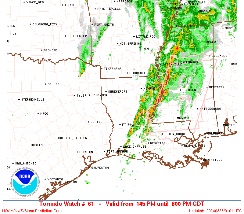
The severe thunderstorm watch area is approximately along and 75
statute miles east and west of a line from 25 miles west northwest
of Muscle Shoals AL to 30 miles east southeast of Natchez MS. For a
complete depiction of the watch see the associated watch outline
update (WOUS64 KWNS WOU1).
PRECAUTIONARY/PREPAREDNESS ACTIONS...
REMEMBER...A Severe Thunderstorm Watch means conditions are
favorable for severe thunderstorms in and close to the watch area.
Persons in these areas should be on the lookout for threatening
weather conditions and listen for later statements and possible
warnings. Severe thunderstorms can and occasionally do produce
tornadoes.
&&
OTHER WATCH INFORMATION...CONTINUE...WW 60...
AVIATION...A few severe thunderstorms with hail surface and aloft to
2.5 inches. Extreme turbulence and surface wind gusts to 60 knots. A
few cumulonimbi with maximum tops to 500. Mean storm motion vector
26035.
...Gleason
   SEL1

   URGENT - IMMEDIATE BROADCAST REQUESTED
   Severe Thunderstorm Watch Number 61
   NWS Storm Prediction Center Norman OK
   505 PM CDT Sun Mar 23 2025

   The NWS Storm Prediction Center has issued a

   * Severe Thunderstorm Watch for portions of
     Northwest Alabama
     Southeast Arkansas
     Northeast Louisiana
     Central Mississippi

   * Effective this Sunday afternoon from 505 PM until Midnight CDT.

   * Primary threats include...
     Scattered large hail likely with isolated very large hail events
       to 2.5 inches in diameter possible
     Scattered damaging wind gusts to 70 mph possible
     A tornado or two possible

   SUMMARY...Scattered severe thunderstorms capable of producing large
   to very large hail around 1.5-2.5 inches in diameter are expected to
   develop and spread eastward through the evening. Damaging winds up
   to 60-70 mph may also occur, especially if convection can develop
   into a line. A tornado or two also appears possible.

   The severe thunderstorm watch area is approximately along and 75
   statute miles east and west of a line from 25 miles west northwest
   of Muscle Shoals AL to 30 miles east southeast of Natchez MS. For a
   complete depiction of the watch see the associated watch outline
   update (WOUS64 KWNS WOU1).

   PRECAUTIONARY/PREPAREDNESS ACTIONS...

   REMEMBER...A Severe Thunderstorm Watch means conditions are
   favorable for severe thunderstorms in and close to the watch area.
   Persons in these areas should be on the lookout for threatening
   weather conditions and listen for later statements and possible
   warnings. Severe thunderstorms can and occasionally do produce
   tornadoes.

   &&

   OTHER WATCH INFORMATION...CONTINUE...WW 60...

   AVIATION...A few severe thunderstorms with hail surface and aloft to
   2.5 inches. Extreme turbulence and surface wind gusts to 60 knots. A
   few cumulonimbi with maximum tops to 500. Mean storm motion vector
   26035.

   ...Gleason
Note:
The Aviation Watch (SAW) product is an approximation to the watch area.
The actual watch is depicted by the shaded areas.
   SAW1
   WW 61 SEVERE TSTM AL AR LA MS 232205Z - 240500Z
   AXIS..75 STATUTE MILES EAST AND WEST OF LINE..
   25WNW MSL/MUSCLE SHOALS AL/ - 30ESE HEZ/NATCHEZ MS/
   ..AVIATION COORDS.. 65NM E/W /29WNW MSL - 31WNW MCB/
   HAIL SURFACE AND ALOFT..2.5 INCHES. WIND GUSTS..60 KNOTS.
   MAX TOPS TO 500. MEAN STORM MOTION VECTOR 26035.

   LAT...LON 34888670 31458956 31459210 34888935

   THIS IS AN APPROXIMATION TO THE WATCH AREA.  FOR A
   COMPLETE DEPICTION OF THE WATCH SEE WOUS64 KWNS
   FOR WOU1.
Watch 61 Status Report Messages:
STATUS REPORT #2 ON WW 61

VALID 240035Z - 240140Z

THE SEVERE WEATHER THREAT CONTINUES ACROSS THE ENTIRE WATCH AREA.

..SPC.03/24/25

ATTN...WFO...HUN...BMX...JAN...

&&

STATUS REPORT FOR WS 61

SEVERE WEATHER THREAT CONTINUES FOR THE FOLLOWING AREAS

ALC033-057-059-075-077-079-083-093-107-127-133-240140-

AL
.    ALABAMA COUNTIES INCLUDED ARE

COLBERT 	     FAYETTE		 FRANKLIN
LAMAR		     LAUDERDALE 	 LAWRENCE
LIMESTONE	     MARION		 PICKENS
WALKER		     WINSTON
$$


ARC003-017-240140-

AR
.    ARKANSAS COUNTIES INCLUDED ARE

ASHLEY		     CHICOT
$$


LAC025-029-035-041-065-067-083-107-123-240140-

LA
.    LOUISIANA PARISHES INCLUDED ARE

CATAHOULA	     CONCORDIA		 EAST CARROLL
FRANKLIN	     MADISON		 MOREHOUSE
RICHLAND	     TENSAS		 WEST CARROLL
$$


MSC001-007-011-015-019-021-025-029-031-037-043-049-051-053-055-
063-065-069-077-079-083-085-087-089-097-099-101-103-105-121-123-
125-127-129-133-149-151-155-159-163-240140-

MS
.    MISSISSIPPI COUNTIES INCLUDED ARE

ADAMS		     ATTALA		 BOLIVAR
CARROLL 	     CHOCTAW		 CLAIBORNE
CLAY		     COPIAH		 COVINGTON
FRANKLIN	     GRENADA		 HINDS
HOLMES		     HUMPHREYS		 ISSAQUENA
JEFFERSON	     JEFFERSON DAVIS	 KEMPER
LAWRENCE	     LEAKE		 LEFLORE
LINCOLN 	     LOWNDES		 MADISON
MONTGOMERY	     NESHOBA		 NEWTON
NOXUBEE 	     OKTIBBEHA		 RANKIN
SCOTT		     SHARKEY		 SIMPSON
SMITH		     SUNFLOWER		 WARREN
WASHINGTON	     WEBSTER		 WINSTON
YAZOO
$$


THE WATCH STATUS MESSAGE IS FOR GUIDANCE PURPOSES ONLY.  PLEASE
REFER TO WATCH COUNTY NOTIFICATION STATEMENTS FOR OFFICIAL
INFORMATION ON COUNTIES...INDEPENDENT CITIES AND MARINE ZONES
CLEARED FROM SEVERE THUNDERSTORM AND TORNADO WATCHES.
$$

STATUS REPORT #1 ON WW 61

VALID 232245Z - 232340Z

THE SEVERE WEATHER THREAT CONTINUES ACROSS THE ENTIRE WATCH AREA.

..SPC..03/23/25

ATTN...WFO...HUN...BMX...JAN...

&&

STATUS REPORT FOR WS 61

SEVERE WEATHER THREAT CONTINUES FOR THE FOLLOWING AREAS

ALC033-057-059-075-077-079-083-093-107-127-133-232340-

AL
.    ALABAMA COUNTIES INCLUDED ARE

COLBERT 	     FAYETTE		 FRANKLIN
LAMAR		     LAUDERDALE 	 LAWRENCE
LIMESTONE	     MARION		 PICKENS
WALKER		     WINSTON
$$


ARC003-017-232340-

AR
.    ARKANSAS COUNTIES INCLUDED ARE

ASHLEY		     CHICOT
$$


LAC025-029-035-041-065-067-083-107-123-232340-

LA
.    LOUISIANA PARISHES INCLUDED ARE

CATAHOULA	     CONCORDIA		 EAST CARROLL
FRANKLIN	     MADISON		 MOREHOUSE
RICHLAND	     TENSAS		 WEST CARROLL
$$


MSC001-007-011-015-019-021-025-029-031-037-043-049-051-053-055-
063-065-069-077-079-083-085-087-089-097-099-101-103-105-121-123-
125-127-129-133-149-151-155-159-163-232340-

MS
.    MISSISSIPPI COUNTIES INCLUDED ARE

ADAMS		     ATTALA		 BOLIVAR
CARROLL 	     CHOCTAW		 CLAIBORNE
CLAY		     COPIAH		 COVINGTON
FRANKLIN	     GRENADA		 HINDS
HOLMES		     HUMPHREYS		 ISSAQUENA
JEFFERSON	     JEFFERSON DAVIS	 KEMPER
LAWRENCE	     LEAKE		 LEFLORE
LINCOLN 	     LOWNDES		 MADISON
MONTGOMERY	     NESHOBA		 NEWTON
NOXUBEE 	     OKTIBBEHA		 RANKIN
SCOTT		     SHARKEY		 SIMPSON
SMITH		     SUNFLOWER		 WARREN
WASHINGTON	     WEBSTER		 WINSTON
YAZOO
$$


THE WATCH STATUS MESSAGE IS FOR GUIDANCE PURPOSES ONLY.  PLEASE
REFER TO WATCH COUNTY NOTIFICATION STATEMENTS FOR OFFICIAL
INFORMATION ON COUNTIES...INDEPENDENT CITIES AND MARINE ZONES
CLEARED FROM SEVERE THUNDERSTORM AND TORNADO WATCHES.
$$
Probability of 1 or more strong (EF2-EF5) tornadoes
Low (10%)
Wind
Probability of 10 or more severe wind events
Mod (50%)
Probability of 1 or more wind events > 65 knots
Low (20%)
Hail
Probability of 10 or more severe hail events
High (70%)
Probability of 1 or more hailstones > 2 inches
Mod (40%)
Combined Severe Hail/Wind
Probability of 6 or more combined severe hail/wind events
High (90%)
For each watch, probabilities for particular events inside the watch
(listed above in each table) are determined by the issuing forecaster.
The “Low” category contains probability values ranging from less than 2%
to 20% (EF2-EF5 tornadoes), less than 5% to 20% (all other probabilities),
“Moderate” from 30% to 60%, and “High” from 70% to greater than 95%.
High values are bolded and lighter in color to provide awareness of
an increased threat for a particular event.