Significant arctic air outbreak will affect large parts of the U.S. from the weekend
3 min read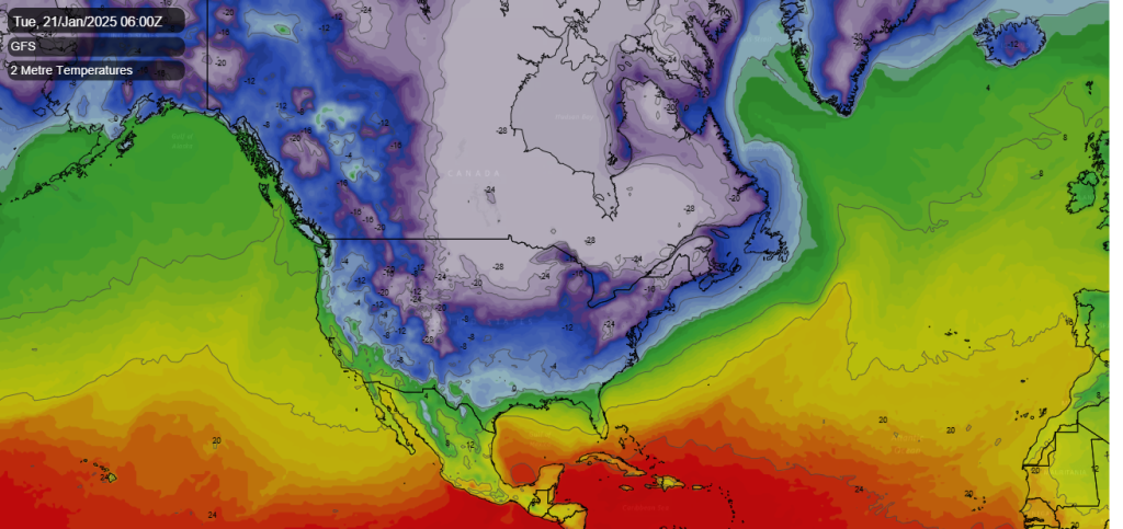
A surge of very cold air looks to drop down from the Arctic over a large area of the central and eastern US this weekend and into early next week. The surge south of bitterly cold arctic air looks to be associated with a stretching of the polar vortex from the arctic down across North America.
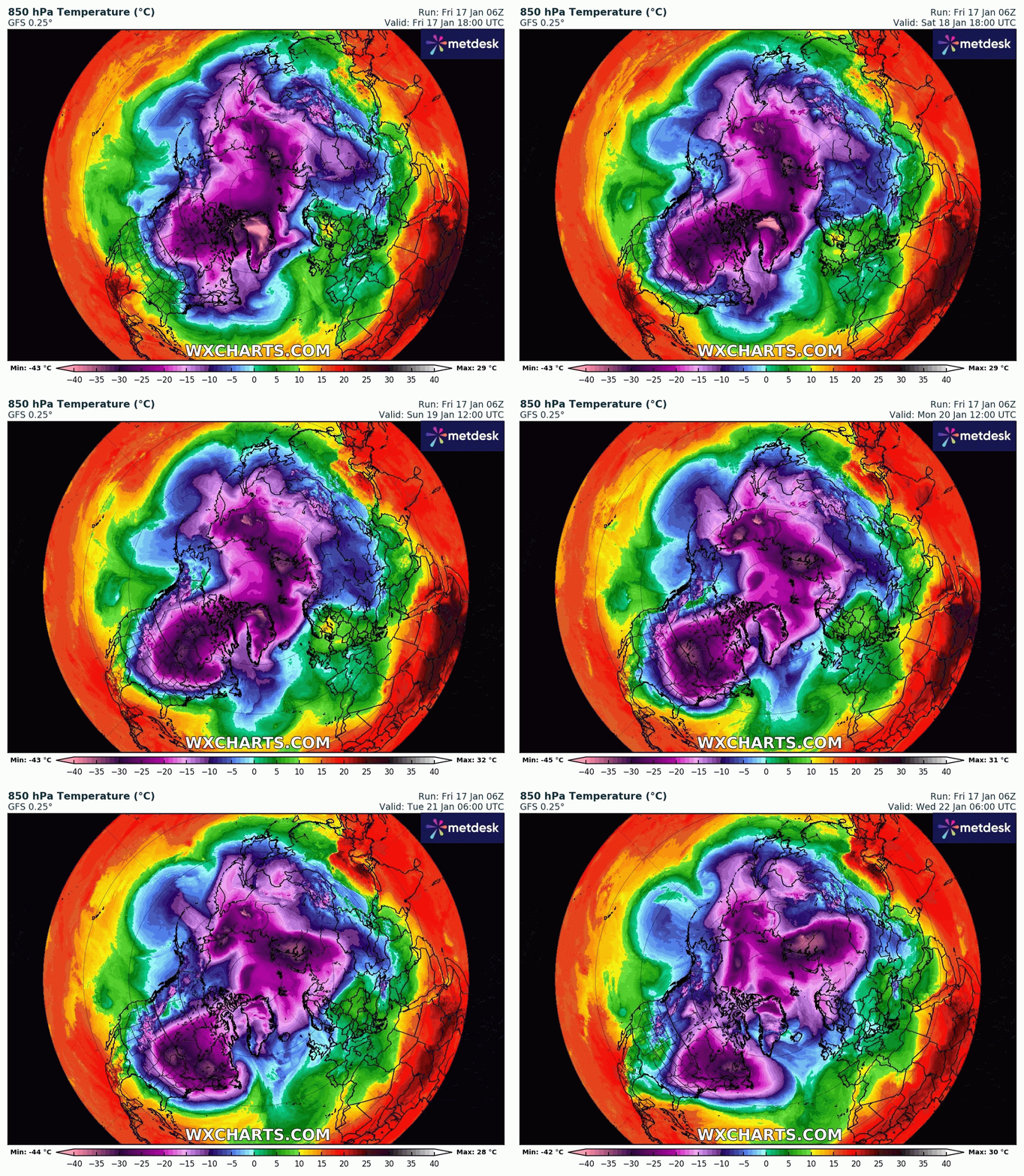
A lobe of the polar vortex, a ring of strong winds high up in the atmosphere that typically keeps the coldest air locked up near the North Pole, will dip southward into the United States this weekend into next week.
Very cold polar air originating from the high arctic is forecast to spread down across the northern Rockies on Saturday, before rapidly moving south and east across much of central and eastern United States by Monday.
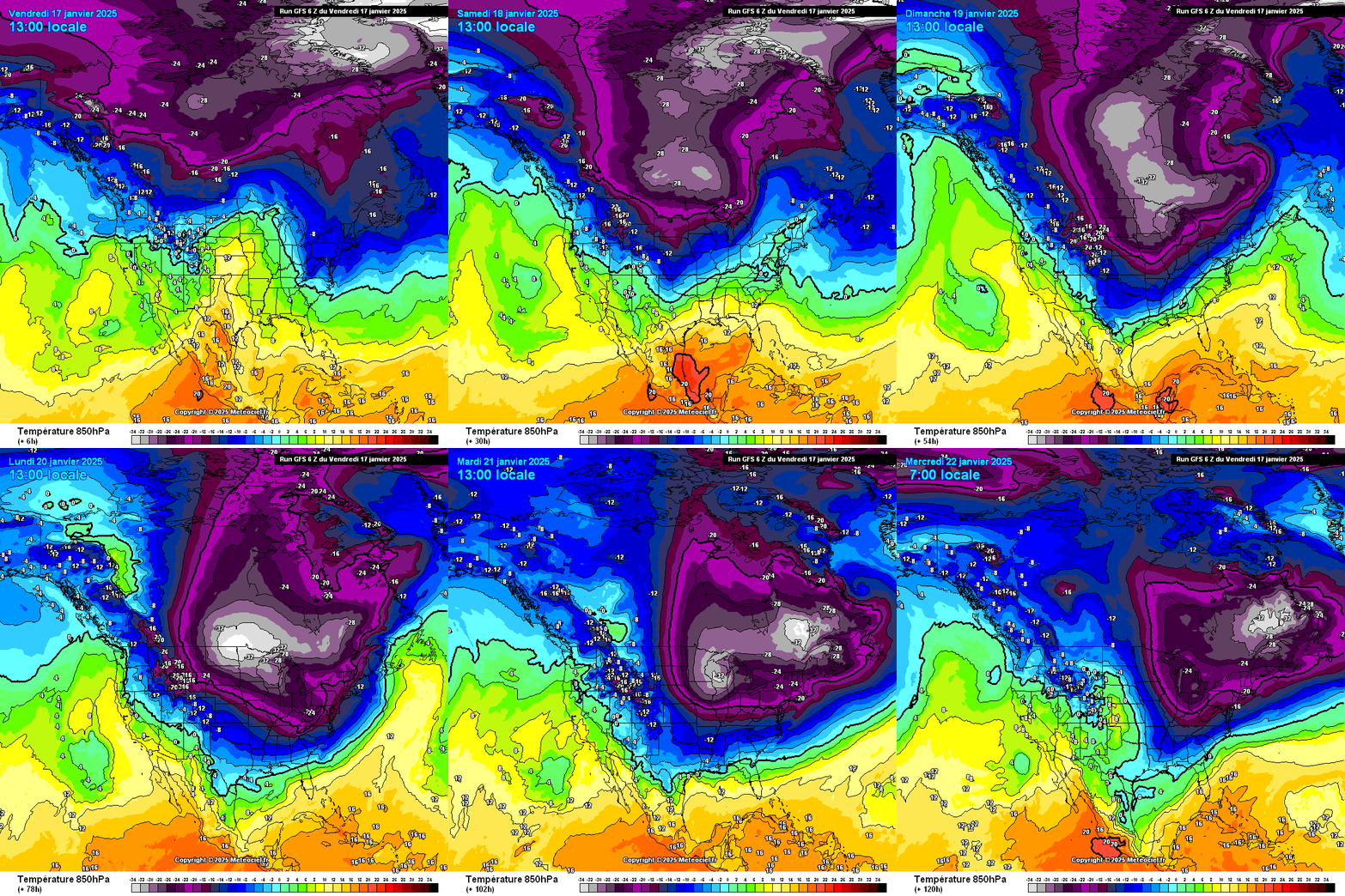
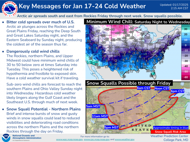
A strong cold front will usher in hazardous cold from the Great Lakes to the southeast U.S. this weekend and into the next week. Temperatures could fall below 0F (-18C) across the Northern Plains by day and as low as -22F (-30C) at night, with sub-20°F (-7C) highs elsewhere. The Rockies, Northern Plains and Upper Midwest could see wind chills of -30 to -50F (-34 to -45C) – posing a heightened risk of hypothermia and frostbite if exposed.
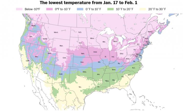
More than 105 million people in the United States could experience subzero temperatures in the next two weeks — covering around 40 states. There will be cold exposure dangers for vulnerable populations, while the low temperatures will put potential strain on power grids, especially in colder regions.
Donald Trump’s inauguration ceremony, which is scheduled to take place on Monday in Washington DC, is forecast 20°F (-6C) temperatures (well below the seasonal average of 38°F, biting winds, and single-digit wind chill. It could be the coldest inauguration day in 40 years. On January 20th 1985 – President Ronald Reagan’s second swearing-in ceremony on January 21 had to be held indoors and the parade was cancelled. The outside temperature at noon was only 7°F, Wind chill temperatures during the afternoon were in the -10 to -20°F (-23 to -28C).
Most won’t see that much in the way of snow, as there will be very little moisture in the cold arctic air, however there is potential for some significant snowfall in places downstream of the Great Lakes and also where the cold arctic air meets with warmer moister air. So there is potential for a winter storms to affect the south and east of the USA, coming after two big winter storms crossed the country during early January. New winter storms could form as the arctic air clashes with the warm, moist air from the Gulf of Mexico and the western Atlantic Ocean.
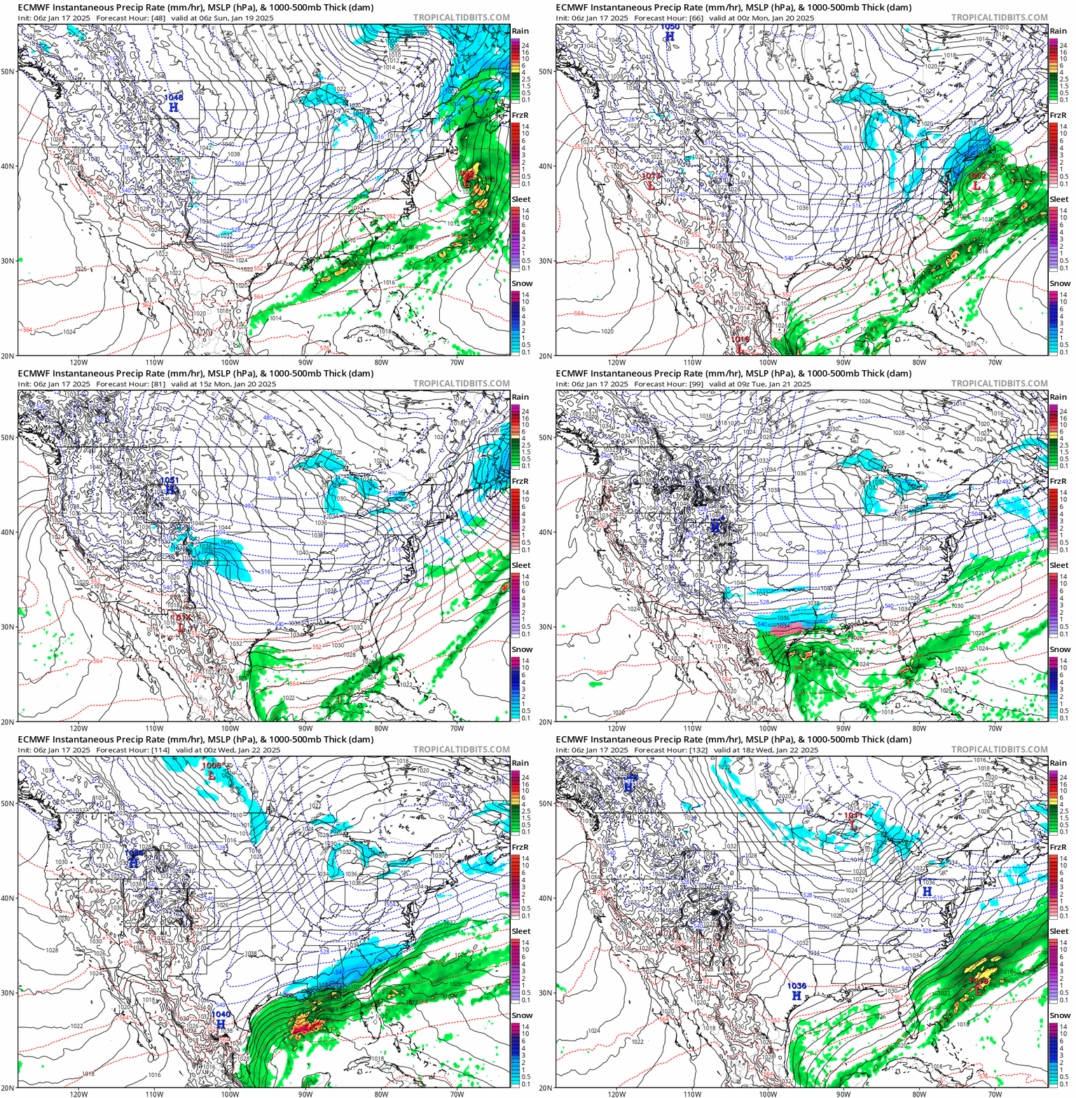
A snowstorm looks to develop around the Ohio valley through to the Mid-Atlantic states on Sunday before moving northeast across New England. Then another winter storm may form in Colorado, New Mexico and the southern Plains early next week. This system has the potential to evolve into a major winter weather-maker for Texas and the Deep South from Monday through Wednesday, spreading snow and ice unusually far south. Places that were affected by last week’s winter storm, such as Dallas and Atlanta, could be hit by more wintry weather in the next ahead. Though there is still a lot of uncertainty, as the storm is still a way off from forming.
Although it will be bitterly cold across large parts of central and eastern USA, it doesn’t look to be record-breaking cold for January. Though a few local records could fall. And for most, it will be dry.

