Trio of atmospheric river storms to dump rain, snow on West
2 min read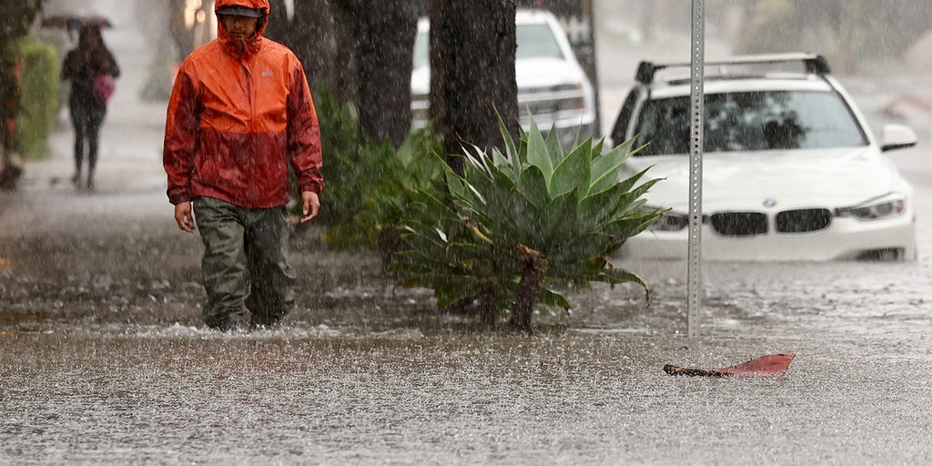
A series of three atmospheric rivers will bring rounds of rain and mountain snow across the West Coast, most notably in northern California, through Monday.
A series of three atmospheric river storms has already started bringing rounds of rain and mountain snow across the West Coast, most notably in northern California, through Monday.
The first atmospheric river moved in Wednesday night and brought rain and mountain snow to northern and central California on Thursday. Up to 4 inches fell in northern California, with less to the south.
DOWNLOAD THE FREE FOX WEATHER APP
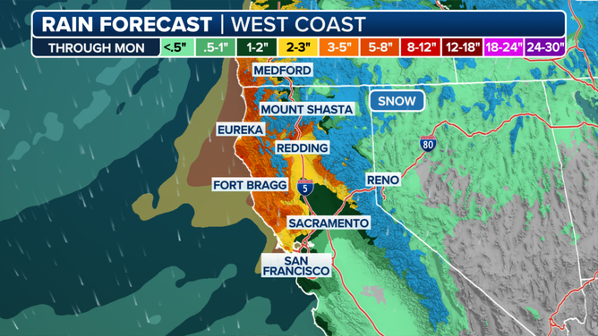
A look at the rain forecast on the West Coast through Monday.
(FOX Weather)
The second and strongest atmospheric river of the group will move into the West Coast later Friday and continue through Saturday, according to the FOX Forecast Center.
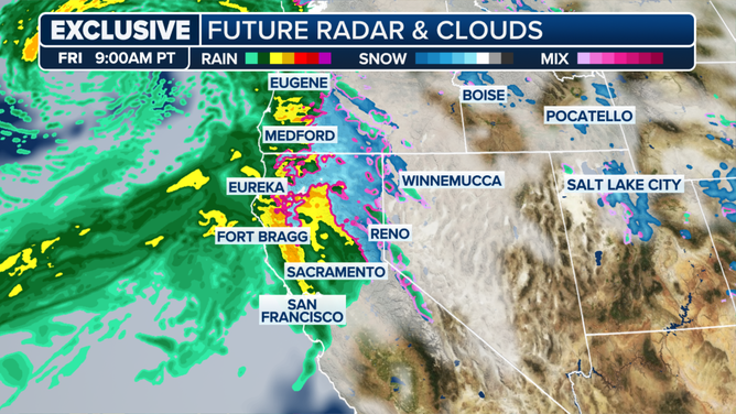
The exclusive FOX Model shows rain and snow covering parts of northern Californa and Oregon on Friday evening.
(FOX Weather)
This storm will bring the potential for significant rain and higher-elevation snow to locations along the central and northern West Coast.
Multiple inches of rain are likely, especially across northern California. This is notable as the heaviest rain will fall on the same areas soaked with up to 23 inches of rain during the Category 5 atmospheric river back in November 2023, the FOX Forecast Center noted.
Flood Watches are in effect for the threat of minor urban and small-stream flooding.
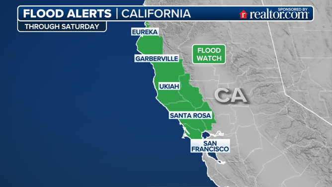
A look at the Flood Watches in effect for parts of California.
(FOX Weather)
There will be more snow with this second system, and several periods of heavy snow are expected.
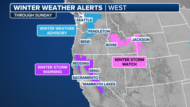
A look at the winter weather alerts in effect for parts of the West through Sunday.
(FOX Weather)
Up to 2 feet could fall in the Sierra Nevada above 5,000 feet, with 3-5 feet closer to the peaks. The heaviest snow is expected during Saturday. Snow-covered roads, chain controls and travel delays will likely result in very difficult travel at times.
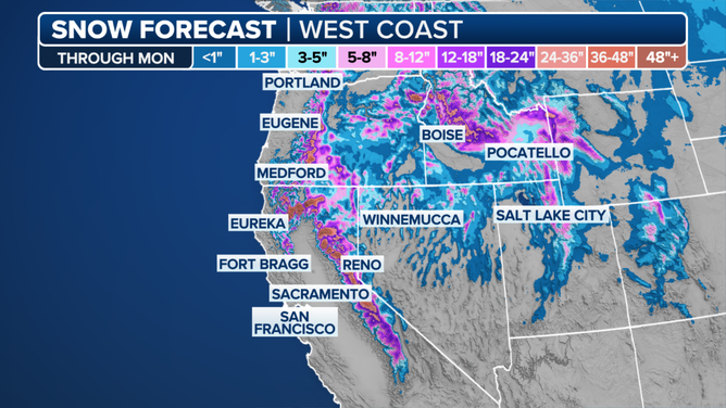
More snow to come along the West Coast through Monday.
(FOX Weather)
Gusty winds are also expected, up to 55 mph over mountain ridges, and this, when coupled with heavy snow, could bring whiteout conditions at times.
The third and much weaker atmospheric river will move in on Monday. Additional flood concerns are not expected, but additional snow may slow mountain travel once again.
https://images.foxweather.com/static.foxweather.com/www.foxweather.com/content/uploads/2024/11/1024/512/gettyimages-1986534374.jpg?ve=1&tl=1
2024-12-13 13:23:43


