Dangerous ice storm causes multiple wrecks along highways across Plains, Midwest
4 min read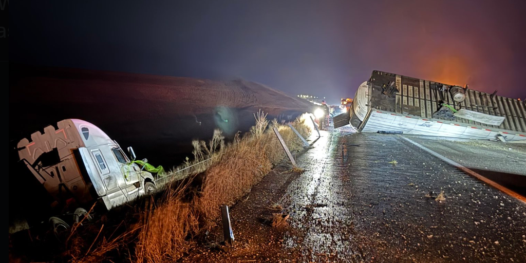
As much as 0.3-0.4 inches of ice accretion was expected across eastern Iowa as a winter storm moved across parts of the Midwest Saturday.
CEDAR RAPIDS, Iowa – A wide area of freezing rain created dangerous travel conditions in the Midwest and Plains during the first half of the weekend with dozens of crashes reported, and hours-long closures of major interstates.
Multiple crashes were reported in Nebraska, Iowa and Missouri as roadways became slick with ice.
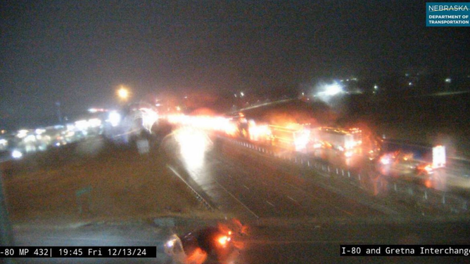
The Omaha metro appeared to be one of the hardest hit areas Friday night with crashes forcing Interstate 80 to close across a 13-mile swath of eastern Nebraska.
(FOX Weather)
Dozens of collisions were also reported in western Iowa as the freezing rain led to refreezing.
“Overnight we had 34 to 40 crashes,” Iowa State Patrol Trooper Bob Conrad told FOX Weather. “We’ve had 100 plus calls for service like people in the ditch.”
Ice Storm Warnings covered over 1.5 million people in eastern Iowa and far northeastern Missouri and northwestern Illinois on Saturday with 0.25-0.40 inches of additional ice accretion, which included areas around Waterloo and Cedar Rapids.
The greatest amounts were reported around Cedar Rapids, where totals approached nearly half an inch of ice, which caused scattered power outages in the southeastern region of the state.

(FOX Weather)
PowerOutage.us reported nearly 15,000 outages on Saturday, which were centered southwest of the Quad Cities.
Those not under ice alerts were under Winter Weather Advisories, which covered much of Iowa and spread into Wisconsin, Minnesota, northern Missouri and eastern Nebraska and South Dakota.
“Dress appropriately. We get so many people that leave their house because they’re warm to jump in the car, to go to the store, go work out or go to the office, and they don’t have the right attire on,” Trooper Conrad said. “If you go in the ditch, it can be life-threatening.”
HOW MUCH ICE IS NEEDED TO KNOCK OUT POWER, DAMAGE TREES?
A car in a neighborhood in Omaha, Nebraska was able to successfully park in their driveway amid icy, slick roads. Road conditions Friday night into Saturday led for tricky commutes and multiple crashes across Iowa and Nebraska.
Forecasters said there is the potential for 0.1-0.2 inches of ice accretion north of Interstate 80 in Iowa outside the Ice Storm Warning areas. According to the FOX Forecast Center, additional ice accretions are possible across areas including Madison in Wisconsin, Minneapolis and Rochester in Minnesota and northwestern Illinois.
Iowa’s Department of Transportation reports nearly all highways are covered in wintry precipitation across the southeastern part of the state.
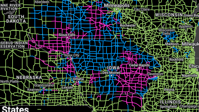
Blue roadways are partially covered and pink roads are fully covered by wintry conditions.
(re.ssec.wisc.edu / FOX Weather)
“Just from standing outside for maybe the past 30, 45 minutes, my coat is starting to freeze over,” FOX Weather Correspondent Brandy Campbell said from Cedar Rapids, Iowa Saturday morning. “(The ice) is starting to build up… the sidewalk is the same situation – I can cut chunks of this ice off.”
Interstate 80 shut down outside of Omaha for over 8 hours
Freezing rain turned Interstate 80 west of Omaha, Nebraska into a sheen of ice Friday night, leading to multiple crashes and poor driving conditions.
Traffic cameras showed vehicles backed up for miles as drivers waited for first responders to attend to crashes. The Nebraska State Patrol closed a 13-mile stretch of I-80 west of Omaha through the night, reopening the highway just after 5 a.m. CT.
Scenes were similar further east in Iowa, where first responders were busy responding to crashes.
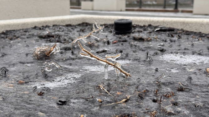
An ice storm coats the ground in Cedar Rapids, Iowa on Dec. 14, 2024.
(FOX Weather)
“First responders, including Trooper Hutson near Mondamin, are assisting with multiple crashes across our state,” the Iowa State Patrol posted on social media. “With rapidly changing weather conditions, we strongly advise avoiding travel if possible.”
Parts of Interstate 880 in western Iowa were shut down from Friday evening into Saturday after a semi-truck appeared to have jackknifed on the icy roadway.
Transportation officials in Iowa told FOX Weather they were pretreating some roadways ahead of the wintry weather but reminded drivers to exercise extra caution during the storm.
Much of the frozen precipitation is expected to melt by the end of the weekend as a significant warm-up moves into the region.
https://images.foxweather.com/static.foxweather.com/www.foxweather.com/content/uploads/2024/12/1024/512/test.png?ve=1&tl=1
2024-12-13 09:00:11


